Aubrey Davis Park Master Plan
Consultation has concluded
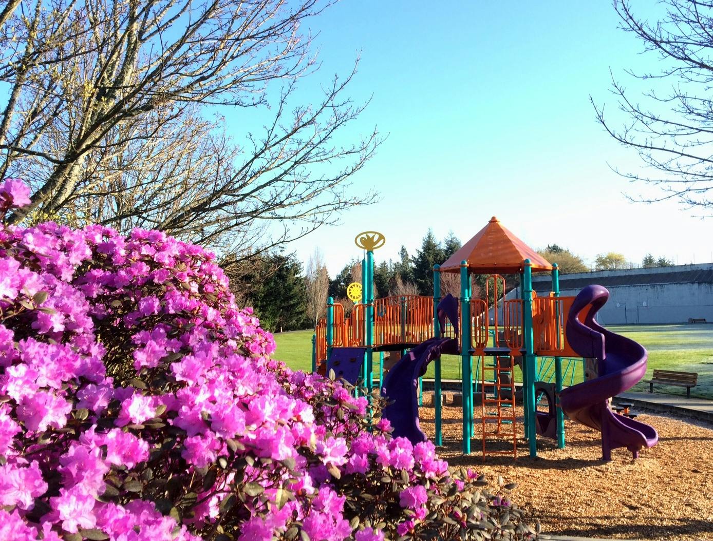
The Park on the Lid, the Mountains to Sound Trail, the Boat Launch and the Greta Hackett Outdoor Sculpture Gallery are all part of Aubrey Davis Park. The City of Mercer Island is leading a master planning process through the fall of 2019 and we need your input! Please help shape the future of this essential community park by participating in the discussion below!
The Park on the Lid, the Mountains to Sound Trail, the Boat Launch and the Greta Hackett Outdoor Sculpture Gallery are all part of Aubrey Davis Park. The City of Mercer Island is leading a master planning process through the fall of 2019 and we need your input! Please help shape the future of this essential community park by participating in the discussion below!
Do you have a question related to the Aubrey Davis Master Plan? Please submit your question here and staff will provide a response.
-
Share Hello, I see there is a community meeting on September 23 which I hope to attend. I just read in Jessi Bon's July report there was "minimal support" for new amenities in the park and was wondering what that meant - did you poll a representative sample of Mercer Island residents for this feedback? There is fast growing participation among kids and adults for natural movement that didn't exist even five years ago. A parkour course (could be part of the playground update) and rock climbing wall would be additive and doesn't exist elsewhere in the park system. There are also few, if any facilities for covered outdoor exercise and given our wet weather, it would be great to have a place to go for year-round outdoor movement like tai chi, yoga, parkour and general movement practice. Think hard court surface with a roof overhead, nothing fancy, though it could be if combined with buildouts on the walls or overhead. The city once responded to growing interest in skateboarding with a skateboard park at Mercerdale. This is no different. Kong Academy's parkour classes at MIBGC and camps at Luther Burbank sell out quickly. They would be an excellent consultative body to assist with a parkour build that would serve MI residents year-round. Incidentally, the owner of Seattle Bouldering Project lives in Mercer Island and one need spend only five minutes in that gigantic facility to see where the future is going with regard to indoor and outdoor recreation. We have enough sport courts - let's use this opportunity to diversify, build for the future and encourage a lifetime of health through movement. on Facebook Share Hello, I see there is a community meeting on September 23 which I hope to attend. I just read in Jessi Bon's July report there was "minimal support" for new amenities in the park and was wondering what that meant - did you poll a representative sample of Mercer Island residents for this feedback? There is fast growing participation among kids and adults for natural movement that didn't exist even five years ago. A parkour course (could be part of the playground update) and rock climbing wall would be additive and doesn't exist elsewhere in the park system. There are also few, if any facilities for covered outdoor exercise and given our wet weather, it would be great to have a place to go for year-round outdoor movement like tai chi, yoga, parkour and general movement practice. Think hard court surface with a roof overhead, nothing fancy, though it could be if combined with buildouts on the walls or overhead. The city once responded to growing interest in skateboarding with a skateboard park at Mercerdale. This is no different. Kong Academy's parkour classes at MIBGC and camps at Luther Burbank sell out quickly. They would be an excellent consultative body to assist with a parkour build that would serve MI residents year-round. Incidentally, the owner of Seattle Bouldering Project lives in Mercer Island and one need spend only five minutes in that gigantic facility to see where the future is going with regard to indoor and outdoor recreation. We have enough sport courts - let's use this opportunity to diversify, build for the future and encourage a lifetime of health through movement. on X (formerly Twitter) Share Hello, I see there is a community meeting on September 23 which I hope to attend. I just read in Jessi Bon's July report there was "minimal support" for new amenities in the park and was wondering what that meant - did you poll a representative sample of Mercer Island residents for this feedback? There is fast growing participation among kids and adults for natural movement that didn't exist even five years ago. A parkour course (could be part of the playground update) and rock climbing wall would be additive and doesn't exist elsewhere in the park system. There are also few, if any facilities for covered outdoor exercise and given our wet weather, it would be great to have a place to go for year-round outdoor movement like tai chi, yoga, parkour and general movement practice. Think hard court surface with a roof overhead, nothing fancy, though it could be if combined with buildouts on the walls or overhead. The city once responded to growing interest in skateboarding with a skateboard park at Mercerdale. This is no different. Kong Academy's parkour classes at MIBGC and camps at Luther Burbank sell out quickly. They would be an excellent consultative body to assist with a parkour build that would serve MI residents year-round. Incidentally, the owner of Seattle Bouldering Project lives in Mercer Island and one need spend only five minutes in that gigantic facility to see where the future is going with regard to indoor and outdoor recreation. We have enough sport courts - let's use this opportunity to diversify, build for the future and encourage a lifetime of health through movement. on Linkedin Email Hello, I see there is a community meeting on September 23 which I hope to attend. I just read in Jessi Bon's July report there was "minimal support" for new amenities in the park and was wondering what that meant - did you poll a representative sample of Mercer Island residents for this feedback? There is fast growing participation among kids and adults for natural movement that didn't exist even five years ago. A parkour course (could be part of the playground update) and rock climbing wall would be additive and doesn't exist elsewhere in the park system. There are also few, if any facilities for covered outdoor exercise and given our wet weather, it would be great to have a place to go for year-round outdoor movement like tai chi, yoga, parkour and general movement practice. Think hard court surface with a roof overhead, nothing fancy, though it could be if combined with buildouts on the walls or overhead. The city once responded to growing interest in skateboarding with a skateboard park at Mercerdale. This is no different. Kong Academy's parkour classes at MIBGC and camps at Luther Burbank sell out quickly. They would be an excellent consultative body to assist with a parkour build that would serve MI residents year-round. Incidentally, the owner of Seattle Bouldering Project lives in Mercer Island and one need spend only five minutes in that gigantic facility to see where the future is going with regard to indoor and outdoor recreation. We have enough sport courts - let's use this opportunity to diversify, build for the future and encourage a lifetime of health through movement. link
Hello, I see there is a community meeting on September 23 which I hope to attend. I just read in Jessi Bon's July report there was "minimal support" for new amenities in the park and was wondering what that meant - did you poll a representative sample of Mercer Island residents for this feedback? There is fast growing participation among kids and adults for natural movement that didn't exist even five years ago. A parkour course (could be part of the playground update) and rock climbing wall would be additive and doesn't exist elsewhere in the park system. There are also few, if any facilities for covered outdoor exercise and given our wet weather, it would be great to have a place to go for year-round outdoor movement like tai chi, yoga, parkour and general movement practice. Think hard court surface with a roof overhead, nothing fancy, though it could be if combined with buildouts on the walls or overhead. The city once responded to growing interest in skateboarding with a skateboard park at Mercerdale. This is no different. Kong Academy's parkour classes at MIBGC and camps at Luther Burbank sell out quickly. They would be an excellent consultative body to assist with a parkour build that would serve MI residents year-round. Incidentally, the owner of Seattle Bouldering Project lives in Mercer Island and one need spend only five minutes in that gigantic facility to see where the future is going with regard to indoor and outdoor recreation. We have enough sport courts - let's use this opportunity to diversify, build for the future and encourage a lifetime of health through movement.
heatherring74 asked almost 7 years agoHi Heather,
Thank you for your feedback and we apologize for the tardy response. We have gotten a couple of suggestions for this park use over the course of the master plan process. We have proposed that the plan not try to evaluate new needs for "sports court" space in this planning process. Instead, the current version of the draft plan allows the programming of court space to be modified in the future based on the outcomes of our Parks, Recreation and Open Space Plan which is updated every six years. The next update will take place in 2020. I would encourage you to be engaged throughout that process so your ideas can be fully considered. Sign up for the MI Weekly e-newsletter and check back on Let's Talk to learn about engagement opportunities as they arise.
-
Share I just looked at the master plan PDF. It appears that the boat launch and parking will remain as is. Am I correct on that interpretation? Thank you. on Facebook Share I just looked at the master plan PDF. It appears that the boat launch and parking will remain as is. Am I correct on that interpretation? Thank you. on X (formerly Twitter) Share I just looked at the master plan PDF. It appears that the boat launch and parking will remain as is. Am I correct on that interpretation? Thank you. on Linkedin Email I just looked at the master plan PDF. It appears that the boat launch and parking will remain as is. Am I correct on that interpretation? Thank you. link
I just looked at the master plan PDF. It appears that the boat launch and parking will remain as is. Am I correct on that interpretation? Thank you.
M. Smith asked almost 7 years agoIn the current version of the plan, the boat launch would remain essentially as it is. The plan does call out a potential new project to create a small shoreline access point south of the boat ramp. This would be separated from the boat ramp by some sort of buffer. This shoreline access would likely be a small beach area with a path to it. This would enable visitors who want to get close to the water to do so without conflicting with trailer traffic. Similarly, kayakers who want to launch there could do so without occupying the boat ramp. Otherwise the boat launch would remain as is.
-
Share Would it be possible to have the illustrated trail sections re-drafted with the trail users shown to scale? The current illustrations appear to show bicycles only two feet wide, vs AASHTO's minimum 30 inch physical width for a standard upright bicycle. Pedestrians appear similarly narrower than reality, which presents a false impression of ample clearance on trail sections that are actually quite narrow for the number of users illustrated. on Facebook Share Would it be possible to have the illustrated trail sections re-drafted with the trail users shown to scale? The current illustrations appear to show bicycles only two feet wide, vs AASHTO's minimum 30 inch physical width for a standard upright bicycle. Pedestrians appear similarly narrower than reality, which presents a false impression of ample clearance on trail sections that are actually quite narrow for the number of users illustrated. on X (formerly Twitter) Share Would it be possible to have the illustrated trail sections re-drafted with the trail users shown to scale? The current illustrations appear to show bicycles only two feet wide, vs AASHTO's minimum 30 inch physical width for a standard upright bicycle. Pedestrians appear similarly narrower than reality, which presents a false impression of ample clearance on trail sections that are actually quite narrow for the number of users illustrated. on Linkedin Email Would it be possible to have the illustrated trail sections re-drafted with the trail users shown to scale? The current illustrations appear to show bicycles only two feet wide, vs AASHTO's minimum 30 inch physical width for a standard upright bicycle. Pedestrians appear similarly narrower than reality, which presents a false impression of ample clearance on trail sections that are actually quite narrow for the number of users illustrated. link
Would it be possible to have the illustrated trail sections re-drafted with the trail users shown to scale? The current illustrations appear to show bicycles only two feet wide, vs AASHTO's minimum 30 inch physical width for a standard upright bicycle. Pedestrians appear similarly narrower than reality, which presents a false impression of ample clearance on trail sections that are actually quite narrow for the number of users illustrated.
jmputnam asked almost 7 years agoThank you for your question and feedback. The final version of the trail sections illustrations have been adjusted to reflect a more accurate bicycle size. The sizes of the people were depicted accurately.
-
Share Hello I am understanding the park where the baseball field may have turf put on it.. This is dangerous to our children, adults and animals.. There are studies on Washington turf and sports.. where 3-4 players were diagnosed with the same cancer a few years apart… Im in remission yet with the possibility of this being a factor I strongly suggest leaving “real grass” in for safety and natural beautiful Coleen Sanders 949-322-8703 on Facebook Share Hello I am understanding the park where the baseball field may have turf put on it.. This is dangerous to our children, adults and animals.. There are studies on Washington turf and sports.. where 3-4 players were diagnosed with the same cancer a few years apart… Im in remission yet with the possibility of this being a factor I strongly suggest leaving “real grass” in for safety and natural beautiful Coleen Sanders 949-322-8703 on X (formerly Twitter) Share Hello I am understanding the park where the baseball field may have turf put on it.. This is dangerous to our children, adults and animals.. There are studies on Washington turf and sports.. where 3-4 players were diagnosed with the same cancer a few years apart… Im in remission yet with the possibility of this being a factor I strongly suggest leaving “real grass” in for safety and natural beautiful Coleen Sanders 949-322-8703 on Linkedin Email Hello I am understanding the park where the baseball field may have turf put on it.. This is dangerous to our children, adults and animals.. There are studies on Washington turf and sports.. where 3-4 players were diagnosed with the same cancer a few years apart… Im in remission yet with the possibility of this being a factor I strongly suggest leaving “real grass” in for safety and natural beautiful Coleen Sanders 949-322-8703 link
Hello I am understanding the park where the baseball field may have turf put on it.. This is dangerous to our children, adults and animals.. There are studies on Washington turf and sports.. where 3-4 players were diagnosed with the same cancer a few years apart… Im in remission yet with the possibility of this being a factor I strongly suggest leaving “real grass” in for safety and natural beautiful Coleen Sanders 949-322-8703
coleen sanders asked about 7 years agoHi Coleen,
Thanks for expressing your concerns and preferences. At this level of master planning we would probably not specify the exact construction of any synthetic turf field. However, you should know that the City's most recent turf project at Island Crest Park used natural cork infill instead of crumb rubber because of citizens' concerns like yours. So synthetic turf can be installed without material that are suspected for health problems.
-
Share Are there plans to resurface the tennis courts? Three out of four are badly cracked and unplayable. on Facebook Share Are there plans to resurface the tennis courts? Three out of four are badly cracked and unplayable. on X (formerly Twitter) Share Are there plans to resurface the tennis courts? Three out of four are badly cracked and unplayable. on Linkedin Email Are there plans to resurface the tennis courts? Three out of four are badly cracked and unplayable. link
Are there plans to resurface the tennis courts? Three out of four are badly cracked and unplayable.
Clare asked about 7 years agoHi Clare, thanks for asking.
We will evaluate the courts and post here any updates we have. We last resurfaced them in 2012.
-
Share Concerned about maintaining the beauty (control graffitti, vandalism, littering, needles, plant destruction), security and safety of the park (buildings, equipment, restrooms, lighting, surveillance camera) and parking availability (not only for handicap) for those who don't bike or live in the convenient vicinity of the park neighborhood. With public funds stretched and type of population (squatting, drug abuse, violence against those who come to enjoy the park) that light rail may be facilitating access and attracting, what proactive plans are being considered and funded other than property taxes and car tabs. on Facebook Share Concerned about maintaining the beauty (control graffitti, vandalism, littering, needles, plant destruction), security and safety of the park (buildings, equipment, restrooms, lighting, surveillance camera) and parking availability (not only for handicap) for those who don't bike or live in the convenient vicinity of the park neighborhood. With public funds stretched and type of population (squatting, drug abuse, violence against those who come to enjoy the park) that light rail may be facilitating access and attracting, what proactive plans are being considered and funded other than property taxes and car tabs. on X (formerly Twitter) Share Concerned about maintaining the beauty (control graffitti, vandalism, littering, needles, plant destruction), security and safety of the park (buildings, equipment, restrooms, lighting, surveillance camera) and parking availability (not only for handicap) for those who don't bike or live in the convenient vicinity of the park neighborhood. With public funds stretched and type of population (squatting, drug abuse, violence against those who come to enjoy the park) that light rail may be facilitating access and attracting, what proactive plans are being considered and funded other than property taxes and car tabs. on Linkedin Email Concerned about maintaining the beauty (control graffitti, vandalism, littering, needles, plant destruction), security and safety of the park (buildings, equipment, restrooms, lighting, surveillance camera) and parking availability (not only for handicap) for those who don't bike or live in the convenient vicinity of the park neighborhood. With public funds stretched and type of population (squatting, drug abuse, violence against those who come to enjoy the park) that light rail may be facilitating access and attracting, what proactive plans are being considered and funded other than property taxes and car tabs. link
Concerned about maintaining the beauty (control graffitti, vandalism, littering, needles, plant destruction), security and safety of the park (buildings, equipment, restrooms, lighting, surveillance camera) and parking availability (not only for handicap) for those who don't bike or live in the convenient vicinity of the park neighborhood. With public funds stretched and type of population (squatting, drug abuse, violence against those who come to enjoy the park) that light rail may be facilitating access and attracting, what proactive plans are being considered and funded other than property taxes and car tabs.
Alice asked over 7 years agoThank you for your question. Security and safety are certainly priorities as we move forward with a master plan for Aubrey Davis Park. A master plan will allow us to anticipate changes such as the Light Rail and plan for how this may affect the park in the future.
The Aubrey Davis Master Plan will incorporate Crime Prevention through Environmental Design (CPTED) concepts and use these as guiding principles when designing concepts for new park facilites. CPTED considers several aspects of design:
Natural Surveillance: Park elements being designed so that there are public eyes on vulnerable areas.
Natural Access Control: Clear definition between public and private spaces, which makes the transition difficult for unauthorized users.
Natural Territory Reinforcement: Creates the perception of “ownership” in a space, so people only feel invited if they know they are supposed to be there.
Pro-active maintenance of the park.
These principles have been developed by urban planning, sociology, architecture and criminology professionals over the last 50 years, and have been shown to drastically reduce crime, and pre-criminal behaviors.
In addition, Parks & Recreation will work closely with the Mercer Island Police Department, King County Metro and Sound Transit to respond to bus riders or transients who are engaged in criminal behavior. As the opening of the Light Rail Station approaches, MIPD plans to train with Sound Transit officers to prepare for security operations and any possible impacts to our community. The goal is for all users of the light rail, and Mercer Island community members to enjoy a safe commuting environment and a safe community. The Aubrey Davis Master Plan concepts are being designed to support this goal.
We anticipate cars will continue to be a primary means of transportation to and from the park for many Mercer Island community members. We are still exploring options for ADA parking and also mindful of preserving Aubrey Davis parking areas for local community members, not commuters. We have not yet identified a clear path for parking, but this remains top of mind as we continue the Aubrey Davis Master Plan process.
-
Share Can you open comments on the Bike/Ped count thread, so questions and answers pertaining to that document can be asked/answered there to provide context? My specific questions: what does "entire trail corridor" mean? The WSDOT map shows only a single, specific sample site along the I-90 trail the island (NMW with SE 26th ST). Other collection points are either not on the trail (SE 84th & SE 26th; SE 27th St and 76th Ave SE) or not on the Island (I-90 Trail at East Channel Bridge. Is this the point at NMW& SE 26th St from which those counts were collected? Or did they have some methodology for synthesizing the count based on samples from all these sites? If it's the former, as raised in Sept 25 meeting, many cyclist - especially commuters - bypass that by diverting north of P&R onto SE 24th / 84th Ave SE. Even if it's the latter, I would expect their methodology to undercount local, non-commuting usage of the I-90 trail substantially. So as a guide for Aubrey Davis Park Master Plan, I'm not sure how informative these numbers really are. on Facebook Share Can you open comments on the Bike/Ped count thread, so questions and answers pertaining to that document can be asked/answered there to provide context? My specific questions: what does "entire trail corridor" mean? The WSDOT map shows only a single, specific sample site along the I-90 trail the island (NMW with SE 26th ST). Other collection points are either not on the trail (SE 84th & SE 26th; SE 27th St and 76th Ave SE) or not on the Island (I-90 Trail at East Channel Bridge. Is this the point at NMW& SE 26th St from which those counts were collected? Or did they have some methodology for synthesizing the count based on samples from all these sites? If it's the former, as raised in Sept 25 meeting, many cyclist - especially commuters - bypass that by diverting north of P&R onto SE 24th / 84th Ave SE. Even if it's the latter, I would expect their methodology to undercount local, non-commuting usage of the I-90 trail substantially. So as a guide for Aubrey Davis Park Master Plan, I'm not sure how informative these numbers really are. on X (formerly Twitter) Share Can you open comments on the Bike/Ped count thread, so questions and answers pertaining to that document can be asked/answered there to provide context? My specific questions: what does "entire trail corridor" mean? The WSDOT map shows only a single, specific sample site along the I-90 trail the island (NMW with SE 26th ST). Other collection points are either not on the trail (SE 84th & SE 26th; SE 27th St and 76th Ave SE) or not on the Island (I-90 Trail at East Channel Bridge. Is this the point at NMW& SE 26th St from which those counts were collected? Or did they have some methodology for synthesizing the count based on samples from all these sites? If it's the former, as raised in Sept 25 meeting, many cyclist - especially commuters - bypass that by diverting north of P&R onto SE 24th / 84th Ave SE. Even if it's the latter, I would expect their methodology to undercount local, non-commuting usage of the I-90 trail substantially. So as a guide for Aubrey Davis Park Master Plan, I'm not sure how informative these numbers really are. on Linkedin Email Can you open comments on the Bike/Ped count thread, so questions and answers pertaining to that document can be asked/answered there to provide context? My specific questions: what does "entire trail corridor" mean? The WSDOT map shows only a single, specific sample site along the I-90 trail the island (NMW with SE 26th ST). Other collection points are either not on the trail (SE 84th & SE 26th; SE 27th St and 76th Ave SE) or not on the Island (I-90 Trail at East Channel Bridge. Is this the point at NMW& SE 26th St from which those counts were collected? Or did they have some methodology for synthesizing the count based on samples from all these sites? If it's the former, as raised in Sept 25 meeting, many cyclist - especially commuters - bypass that by diverting north of P&R onto SE 24th / 84th Ave SE. Even if it's the latter, I would expect their methodology to undercount local, non-commuting usage of the I-90 trail substantially. So as a guide for Aubrey Davis Park Master Plan, I'm not sure how informative these numbers really are. link
Can you open comments on the Bike/Ped count thread, so questions and answers pertaining to that document can be asked/answered there to provide context? My specific questions: what does "entire trail corridor" mean? The WSDOT map shows only a single, specific sample site along the I-90 trail the island (NMW with SE 26th ST). Other collection points are either not on the trail (SE 84th & SE 26th; SE 27th St and 76th Ave SE) or not on the Island (I-90 Trail at East Channel Bridge. Is this the point at NMW& SE 26th St from which those counts were collected? Or did they have some methodology for synthesizing the count based on samples from all these sites? If it's the former, as raised in Sept 25 meeting, many cyclist - especially commuters - bypass that by diverting north of P&R onto SE 24th / 84th Ave SE. Even if it's the latter, I would expect their methodology to undercount local, non-commuting usage of the I-90 trail substantially. So as a guide for Aubrey Davis Park Master Plan, I'm not sure how informative these numbers really are.
Erik asked over 7 years agoHi Erik,
There is now a comment section open and available on the Bike/Ped count thread. These counts are just one piece of information that we are using to look at uses and needs for the master plan. We realize they have limitations as you point out and this is taken into consideration in the analysis of trail use. It is beyond the scope of this effort to perform comprehensive trail use counts specific to Mercer Island. We will pass along your clarifying questions to WSDOT to see if they can provide additional information on their methodology and locations for their data.
-
Share Recently Field A of the lid park (next to the bathrooms) was restriped for I believe a soccer field. Can you answer the following questions re: the restriping: 1. Was there any public notice or public participation in the decision to restripe the field. Who approved this decision? I have attended all three Aubrey Davis Master Plan focus group meetings, including active and passive recreation, and don't remember any notice of the restriping of Field A? 2. What is the purpose and basis of the restriping? Did someone or a group request the new restriped field? 3. Who is eligible to use the restriped field, and can off Island groups reserve and use the field? 4. What is the schedule for the restriped field, and where can I find that. 5. What is the cost to reserve and use the field? 6. Is the restriping temporary or permanent? 6. The grass growing season has ended. In the past Field A would be closed to preserve the grass. What are the plans to restore the grass condition from the use on the new restriped field? 7. Field A is the main multi-use part of the lid park, with pedestrians, dog walkers, and recreational users. The new restriped field effectively consumes all of Field A. What are the rules for using Field A when there is an organized on the new restriped field? Are citizens prohibited from using this part of the lid park during an organized event on the new restriped field? Thank you. on Facebook Share Recently Field A of the lid park (next to the bathrooms) was restriped for I believe a soccer field. Can you answer the following questions re: the restriping: 1. Was there any public notice or public participation in the decision to restripe the field. Who approved this decision? I have attended all three Aubrey Davis Master Plan focus group meetings, including active and passive recreation, and don't remember any notice of the restriping of Field A? 2. What is the purpose and basis of the restriping? Did someone or a group request the new restriped field? 3. Who is eligible to use the restriped field, and can off Island groups reserve and use the field? 4. What is the schedule for the restriped field, and where can I find that. 5. What is the cost to reserve and use the field? 6. Is the restriping temporary or permanent? 6. The grass growing season has ended. In the past Field A would be closed to preserve the grass. What are the plans to restore the grass condition from the use on the new restriped field? 7. Field A is the main multi-use part of the lid park, with pedestrians, dog walkers, and recreational users. The new restriped field effectively consumes all of Field A. What are the rules for using Field A when there is an organized on the new restriped field? Are citizens prohibited from using this part of the lid park during an organized event on the new restriped field? Thank you. on X (formerly Twitter) Share Recently Field A of the lid park (next to the bathrooms) was restriped for I believe a soccer field. Can you answer the following questions re: the restriping: 1. Was there any public notice or public participation in the decision to restripe the field. Who approved this decision? I have attended all three Aubrey Davis Master Plan focus group meetings, including active and passive recreation, and don't remember any notice of the restriping of Field A? 2. What is the purpose and basis of the restriping? Did someone or a group request the new restriped field? 3. Who is eligible to use the restriped field, and can off Island groups reserve and use the field? 4. What is the schedule for the restriped field, and where can I find that. 5. What is the cost to reserve and use the field? 6. Is the restriping temporary or permanent? 6. The grass growing season has ended. In the past Field A would be closed to preserve the grass. What are the plans to restore the grass condition from the use on the new restriped field? 7. Field A is the main multi-use part of the lid park, with pedestrians, dog walkers, and recreational users. The new restriped field effectively consumes all of Field A. What are the rules for using Field A when there is an organized on the new restriped field? Are citizens prohibited from using this part of the lid park during an organized event on the new restriped field? Thank you. on Linkedin Email Recently Field A of the lid park (next to the bathrooms) was restriped for I believe a soccer field. Can you answer the following questions re: the restriping: 1. Was there any public notice or public participation in the decision to restripe the field. Who approved this decision? I have attended all three Aubrey Davis Master Plan focus group meetings, including active and passive recreation, and don't remember any notice of the restriping of Field A? 2. What is the purpose and basis of the restriping? Did someone or a group request the new restriped field? 3. Who is eligible to use the restriped field, and can off Island groups reserve and use the field? 4. What is the schedule for the restriped field, and where can I find that. 5. What is the cost to reserve and use the field? 6. Is the restriping temporary or permanent? 6. The grass growing season has ended. In the past Field A would be closed to preserve the grass. What are the plans to restore the grass condition from the use on the new restriped field? 7. Field A is the main multi-use part of the lid park, with pedestrians, dog walkers, and recreational users. The new restriped field effectively consumes all of Field A. What are the rules for using Field A when there is an organized on the new restriped field? Are citizens prohibited from using this part of the lid park during an organized event on the new restriped field? Thank you. link
Recently Field A of the lid park (next to the bathrooms) was restriped for I believe a soccer field. Can you answer the following questions re: the restriping: 1. Was there any public notice or public participation in the decision to restripe the field. Who approved this decision? I have attended all three Aubrey Davis Master Plan focus group meetings, including active and passive recreation, and don't remember any notice of the restriping of Field A? 2. What is the purpose and basis of the restriping? Did someone or a group request the new restriped field? 3. Who is eligible to use the restriped field, and can off Island groups reserve and use the field? 4. What is the schedule for the restriped field, and where can I find that. 5. What is the cost to reserve and use the field? 6. Is the restriping temporary or permanent? 6. The grass growing season has ended. In the past Field A would be closed to preserve the grass. What are the plans to restore the grass condition from the use on the new restriped field? 7. Field A is the main multi-use part of the lid park, with pedestrians, dog walkers, and recreational users. The new restriped field effectively consumes all of Field A. What are the rules for using Field A when there is an organized on the new restriped field? Are citizens prohibited from using this part of the lid park during an organized event on the new restriped field? Thank you.
Daniel Thompson asked over 7 years agoHi Dan, I hope these responses are what you are looking for.
1. Was there any public notice or public participation in the decision to restripe the field. Who approved this decision? I have attended all three Aubrey Davis Master Plan focus group meetings, including active and passive recreation, and don't remember any notice of the restriping of Field A?
Our field configurations at all of our athletic field sites change seasonally as part of ordinary park operations according to our field use policy. We do not provide public notice for field striping.
2. What is the purpose and basis of the restriping? Did someone or a group request the new restriped field?
The fields were restriped to accommodate soccer. Soccer is the designated priority fall sport. Lacrosse and baseball are the priority spring sports. No individual renter requested the soccer striping. Rental customers can request additional striping for an extra cost.
3. Who is eligible to use the restriped field, and can off Island groups reserve and use the field?
Field use is open to any group that reserves the field per our current field use policy and registration procedures.
4. What is the schedule for the restriped field, and where can I find that.
We can provide field schedules via a public records request. When submitting a public records request, please indicate the date range you are interested in so that we can do an appropriate query in our registration system.
5. What is the cost to reserve and use the field?
Field rental costs are available on our athletic field fees rate sheet.
6. Is the restriping temporary or permanent?
This is a natural grass field. All striping is temporary and changes occasionally based on field reservations.
7. The grass growing season has ended. In the past Field A would be closed to preserve the grass. What are the plans to restore the grass condition from the use on the new restriped field?
The field is to be closed around or after Thanksgiving. It will be closed until March. Grass fields are renovated on a annual schedule. Typically the field is groomed four times a years with a combination of aerating, fertilizing and seeding. Specific treatments are tailored to the specific condition of the turf.
8. Field A is the main multi-use part of the lid park, with pedestrians, dog walkers, and recreational users. The new restriped field effectively consumes all of Field A. What are the rules for using Field A when there is an organized on the new restriped field? Are citizens prohibited from using this part of the lid park during an organized event on the new restriped field? Thank you.
Yes, when the athletic field is reserved for an organized activity, all other uses must relocate. This is standard protocol for all athletic fields. Mercer Island City Code additionally prohibits animals from athletic fields when practices, games or other organized sports are in progress.
-
Share Many trees have died between Sunset Highway sculpture park and the freeway. This exposes the new light rail station and opens up noise and carbon emissions for those of us living in the 77 Central apartments facing I-90. Will there be replacement trees to combat noise and air pollution as envisioned by Aubrey Davis? on Facebook Share Many trees have died between Sunset Highway sculpture park and the freeway. This exposes the new light rail station and opens up noise and carbon emissions for those of us living in the 77 Central apartments facing I-90. Will there be replacement trees to combat noise and air pollution as envisioned by Aubrey Davis? on X (formerly Twitter) Share Many trees have died between Sunset Highway sculpture park and the freeway. This exposes the new light rail station and opens up noise and carbon emissions for those of us living in the 77 Central apartments facing I-90. Will there be replacement trees to combat noise and air pollution as envisioned by Aubrey Davis? on Linkedin Email Many trees have died between Sunset Highway sculpture park and the freeway. This exposes the new light rail station and opens up noise and carbon emissions for those of us living in the 77 Central apartments facing I-90. Will there be replacement trees to combat noise and air pollution as envisioned by Aubrey Davis? link
Many trees have died between Sunset Highway sculpture park and the freeway. This exposes the new light rail station and opens up noise and carbon emissions for those of us living in the 77 Central apartments facing I-90. Will there be replacement trees to combat noise and air pollution as envisioned by Aubrey Davis?
dennyhenkel asked over 7 years agoHello Denny,
We are very aware of the tree loss in Aubrey Davis Park. Tree replacement has been put off because we need the master plan to address the underlying conditions that have led to tree mortality and identify what the capital needs are to sustain the landscape. You are right, the landscape was an integral part of the original project to mitigate the impact of the expanded freeway through Mercer Island and we will consider different ways to restore the landscape as part of the Master Planning process.. We recommend that you comment about this topic on Let’s Talk to make sure your perspective is part of the public record.
The trees in the highway canyon are not part of Aubrey Davis Park and are solely maintained by WSDOT. They are outside of the scope of the master plan.
-
Share When will the city receive the bike count data for the Aubrey Davis Trail corridor and post that on this site? My last question 8 days ago requesting this information and the city's answer is below and noted the city had requested this information from WSDOT. Will the data include uses other than bicycles? How did WSDOT obtain the data? How was the city able to recommend a trail width east of the town center based on estimated future use of the trail without any use data? How did the city estimate future use on the Trail? What was the city's estimated future use on the Trail broken down for bicycles, pedestrians, and other users? on Facebook Share When will the city receive the bike count data for the Aubrey Davis Trail corridor and post that on this site? My last question 8 days ago requesting this information and the city's answer is below and noted the city had requested this information from WSDOT. Will the data include uses other than bicycles? How did WSDOT obtain the data? How was the city able to recommend a trail width east of the town center based on estimated future use of the trail without any use data? How did the city estimate future use on the Trail? What was the city's estimated future use on the Trail broken down for bicycles, pedestrians, and other users? on X (formerly Twitter) Share When will the city receive the bike count data for the Aubrey Davis Trail corridor and post that on this site? My last question 8 days ago requesting this information and the city's answer is below and noted the city had requested this information from WSDOT. Will the data include uses other than bicycles? How did WSDOT obtain the data? How was the city able to recommend a trail width east of the town center based on estimated future use of the trail without any use data? How did the city estimate future use on the Trail? What was the city's estimated future use on the Trail broken down for bicycles, pedestrians, and other users? on Linkedin Email When will the city receive the bike count data for the Aubrey Davis Trail corridor and post that on this site? My last question 8 days ago requesting this information and the city's answer is below and noted the city had requested this information from WSDOT. Will the data include uses other than bicycles? How did WSDOT obtain the data? How was the city able to recommend a trail width east of the town center based on estimated future use of the trail without any use data? How did the city estimate future use on the Trail? What was the city's estimated future use on the Trail broken down for bicycles, pedestrians, and other users? link
When will the city receive the bike count data for the Aubrey Davis Trail corridor and post that on this site? My last question 8 days ago requesting this information and the city's answer is below and noted the city had requested this information from WSDOT. Will the data include uses other than bicycles? How did WSDOT obtain the data? How was the city able to recommend a trail width east of the town center based on estimated future use of the trail without any use data? How did the city estimate future use on the Trail? What was the city's estimated future use on the Trail broken down for bicycles, pedestrians, and other users?
Daniel Thompson asked almost 8 years agoHi Daniel,
We recently received pedestrian and bike count data from WSDOT for the I-90 trail. The report shows a daily and monthly pedestrian and bike count from 2016-2018, along with an overall monthly average. The report can be found in the Document Library to the right, or simply click here.
For more information on how this data was collected and to visit the WSDOT Bicycle & Pedestrian Count Portal, click here:
-
Gathering Ideas - Community Engagement
Aubrey Davis Park Master Plan has finished this stage -
Site Analysis, Vision, Programming and Design Criteria
Aubrey Davis Park Master Plan has finished this stage -
Concept Alternatives
Aubrey Davis Park Master Plan has finished this stage -
Draft Master Plan with Preferred Alternatives
Aubrey Davis Park Master Plan has finished this stage -
Final Adoption of Master Plan
Aubrey Davis Park Master Plan is currently at this stage
-
December 03 2019