Aubrey Davis Park Master Plan
Share Aubrey Davis Park Master Plan on Facebook
Share Aubrey Davis Park Master Plan on X (formerly Twitter)
Share Aubrey Davis Park Master Plan on Linkedin
Email Aubrey Davis Park Master Plan link
Consultation has concluded
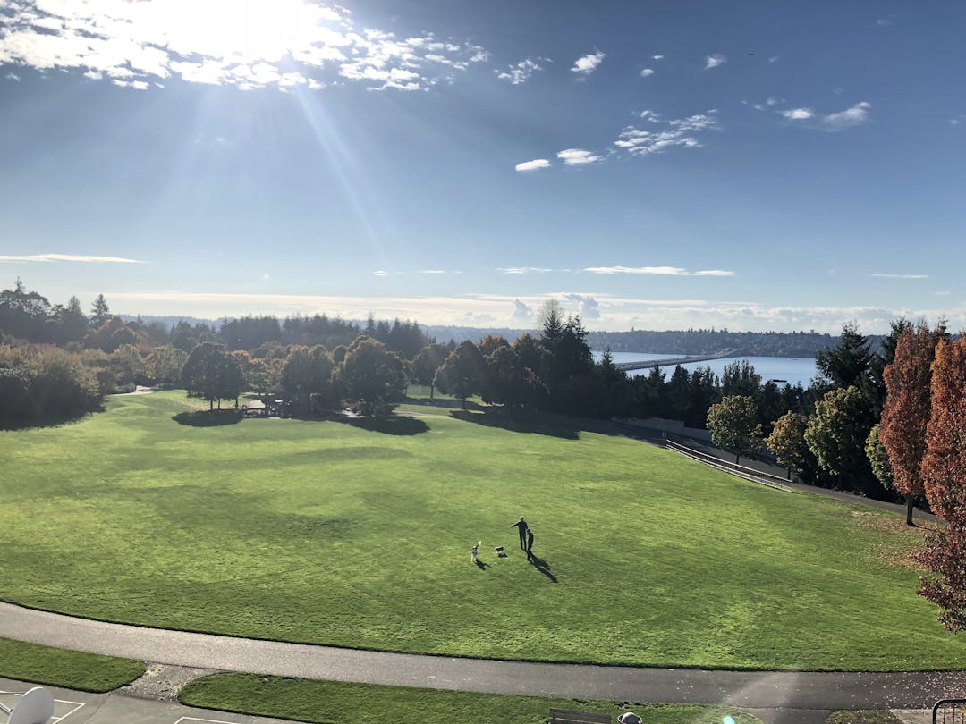
The Park on the Lid, the Mountains to Sound Trail, the Boat Launch and the Greta Hackett Outdoor Sculpture Gallery are all part of Aubrey Davis Park. The City of Mercer Island is leading a master planning process through the fall of 2019 and we need your input! Please help shape the future of this essential community park by participating in the discussion below!


My husband and I walk the trail regularly. Our wish list includes: 1-portable potty opportunities, 2-safety measures need to be put in place where there are street crossings (near Covenant Shores and near Shorewood Apts) 3-separate lanes for bikes and pedestrians - the bicycle riders are having a grand time going as fast as possible, passing one another and scaring pedestrians.
I ask the planners not to take away any open park space, including the sculpture garden path, for any uses such as buildings or parking. Every part of the park is valuable and scarce.
Liabilty and Design Of Path Through Lid Park/ADMP
Mon 1/14/2019, 11:46 AM
You; council@mercergov.org; julie.underwood@mercergov.org; Paul West; 'kari.sand@mercergov.org'+8 others
Dear Council, Tuesday night you are scheduled to receive an update on the Aubrey Davis Master Plan. I attended all four focus group meetings, as did some of the citizens copied on this email. Throughout the meetings an important issue was the path that runs from the western exit from I-90 to the East Channel Bridge. Many of the comments are on Let's Talk and I suggest you read those comments before tomorrow night's meeting.
I have emailed you before about this subject. The path in effect has five different sections. This email concerns the section that runs through the lid park.
No doubt you have heard about the serious bicycle accident on the lid park path on the descent towards West Mercer Way. The bicyclist, a doctor I am told, suffered serious head injuries when a dog approached him. This injury is hardly a surprise and was predicted during the focus group meetings.
The critical issues re: this part of the path are:
1 It does not enjoy recreational use immunity.
2 It has several sections that have steep declines encouraging high bike speeds.
3 It has no speed signage and no traffic calming measures despite years of collisions or near collisions.
4 It is a narrow mixed use path serving pedestrians, recreational bicyclists and serious bicyclists in both directions.
5 It has several areas in which kids, dogs and adults must cross the path (at the bottom of the descents) to reach play fields, play grounds and the park, often from shrubbery.
The city's outside consultant's approach was to widen the path which the citizens objected to simply based on aesthetics. The city's consultant insists on using an unpublished King Co. regulation requiring 14' wide paths with two foot shoulders whereas WSDOT requires only 10' wide paths.
But the issue is it is impossible to have a safe mixed use path with steep descents in both directions and high speed bicycles. I live next to the park on the eastern descent towards the TC and I have been writing the city about speeds on the path for nearly 10 years. My concern is the city has been more focused on pleasing Island bicycle groups than addressing the speeds and safety on the path.
The focus group recognized the only way to make this path safe for everyone is to control speeds to the lowest common denominator, which is pedestrian speeds. A wider path only encourages higher speeds, and there is not the space to create separate dedicated paths, and kids and dogs don't recognized dedicated paths.
To do this will require three steps.
1 Much better signage on speeds on the path through the park, and alternative bike paths along WMW and NMW.
2 Traffic calming in the form of round abouts, with one at the bottom of the descent next to the ballfield and across from the parking lot, one at the playground on the western part of the path next to WMW (where the most recent accident occurred), and one that snakes behind the bathroom to slow speeds before beginning the steep descent towards the TC.
3 A better alternative bike path for serious bicyclists along WMW and NMW.
The best way to mitigate liability is to promote and enhance safety. Right now this path is not safe for any of the user groups, and the city has not done a very good job addressing the known hazards. You can't mix kids, dogs, pedestrians and high speed bicycles on a steep path and not expect serious injuries. We can begin with signage, but unless the city and WSDOT eliminate the speed differential between bicyclists and pedestrians this will never be a safe path to ride or walk along, and this is something I have been writing to the city and council about for 10 years, including four focus group meetings.
Thank you.
Daniel Thompson
Some comments about improving the I-90 Trail.
1) Who uses the trail? As a volunteer in multiple WSDOT annual bike counts at the intersection of ICW and 26th Street next to the West bound I-90 exit, those counts show that the I-90 Trail is well used by commuters on foot, scooters, and bicycles. Commuters on bicycles and scooters outnumber pedestrians.
2) Trees. The King County Sewer project is going to take out the trees along NMW during construction, so designing an attractive foliage/tree replacement should not be a problem.
3) North Mercer Way. The cost and engineering challenges of establishing bikes lanes on NMW will be prohibitive. While some serious cyclists may use NMW, many commuters, families and those fearful of riding in traffic will not.
4) Sharing the trail. The 520 bridge adheres to the 14' width and is shared comfortably by all forms of active transportation: pedestrians, bicycles, and scooters. A wider, well-lit trail would improve safety for all who use it.
5) Future growth. The $200M+ expansion of bicycle facilities underway in both the Eastside and in Seattle along with the planned expansion of employment and housing in the Bellevue Spring District, will greatly increase the traffic on this trail. We need to plan for it.
The Aubrey Davis Park Master Plan is a unique opportunity to correct existing problems, and more importantly, to plan for the future at a time when multiple groups can share in the cost of improvements. The plan should aim to safely accommodate changing transportation options and future increases in traffic, not keep the status quo.
Let’s add more places in the park that encourage people to gather for reasons beyond sports. Being sheltered from the rain while gathering is helpful, though not required.
Being able to hear each other can be tough with larger groups, so pay attention to acoustics. It would be neat if there were a place in the park known regionally for its unique "unplugged" acoustics. That could attract small singing groups and instrumental ensembles to practice and perform here.
The park is long and narrow, so it’s normal that people will be walking, jogging, and biking through it. I’d like to see a piece of art that reacts to and encourages the moving viewer – for example, something that exposes differently angled surfaces to viewers in different locations, so people see dramatically evolving views of the same artwork as they move past it.
Some parts of the park are high enough to have good views. We could put a piece of art there that complements the view and might encourage people to take pictures that include both the view and the artwork. Sharing of the photos would help improve the “brand” of the park and its art.
With the Island’s big focus on children, the park should have art that encourages kids to climb and play on it.
One concern I have is the six year Capital Improvement Program shows implementation costs for the ADMP of $1.516 million unfunded, with only $325,000 to be funded by the city, and the rest to be funded by "other" (although $305,000 for regional trail connections is shown as funded by the city and I assume separate from King Co.'s replacement of the trail east of the TC as part of the sewer upgrade project, although I don't which part of the trail the city's $305,00 applies to). https://mercerisland.onbaseonline.com/mercerisland/1702AppNetAgenda/Documents/ViewDocument/AB5497.pdf.pdf?meetingId=641&documentType=Agenda&itemId=1673&publishId=1868&isSection=false
During the focus group meetings we have been asked to assume cost is not an object. I understand the city is hoping WSDOT agrees the funding for implementation is part of WSDOT's obligations under the Turn Back agreements that divide responsibility for capital projects and maintenance between the city and WSDOT, or WSDOT agrees to use the sales proceeds from the city's property next to Freshy's for the city's share of costs, but I am not sure the sale of the property next to Freshy's will happen or WSDOT will agree to fund the costs of implementation.
I think these focus group meetings need to take into account just how much money will really be available for implementation, and if we need to prioritize projects now is the time to do it. Replacing the irrigation system and soil remediation to stop the trees from dying are critical and must have priority over any kind of capital improvements. The total projected implementation costs -- $1.516 million -- would not cover the cost of artificial turf or lights -- which the focus group has unanimously rejected -- or many of the other wish lists for capital improvements like another bathroom. Another concern is any regional grants usually come with requirements that the park be developed to serve those regional interests, which almost always favor active over passive use.
I also live right next to ADP and understand Cristopher Lee's concerns in his comments below. Maybe the tennis courts should be left there; I just wanted to let readers know some ideas that were thrown around, when budgets and costs were unlimited according to the facilitator. The amphitheater would be grass with maybe wood benches not unlike the outdoor theater at Luther Burbank Park, and would replace the impervious surfaces and chain link fence for the tennis courts, although it would reduce recreation.
What Christopher, the focus group attendees, and I agree on 100% is that the green spaces, trees and natural feel of the park be maintained. The two focus group meetings that concerned us related to 1. the trail; and 2. active recreation, because each of these proposals increase impervious surfaces and development in the lid park or along the corridor, and for both uses the city and its outside consultants appeared to have preordained ideas that were designed to benefit the region through development of the park more than the citizens and users of ADP.
The next focus group meeting is on Nov. 8 and involves passive recreation, which in many ways is the obverse of active recreation if active recreation involves increased impervious surfaces. I hope at the next focus group meeting we can have a frank discussion on just how much money there will be for implementation of the ADMP so we can begin to prioritize. The good news is the citizens and focus group members don't think much needs to be done to this lovely and natural park and corridor except the irrigation system and soil remediation to preserve its green qualities, although I am not sure the city's outside consultants agree with that view.
I read the recent notes from the community engagement discussion with great interest. I live next to Aubrey Davis Park and frequent it on almost a daily basis. As a resident and homeowner, I am entirely supportive of preserving the green spaces, sports fields, and walkability. I strongly oppose the idea of an outside amphitheater replacing the tennis courts. This would be completely in conflict with preserving the green spaces and the park's focus on green space and sports activities. It would increase parking traffic in the surrounding neighborhood streets as their is just enough parking for sports activities right now. I would also argue that these are the best tennis courts on the island. Rather than get rid of them, just advertise them better. I actually believe that these tennis courts are just as highly used as any other set of courts on the island (a study could be conducted to prove that they are less frequented if that is the argument for getting rid of them). These courts are definitely more used than the one at Roanoke Park down the road and other public courts on the island.
Last night's focus group meeting on active recreation was very productive, and I think a lot of citizen skepticism over the decision on trail width east of the TC was addressed.
Re: trail width east of the TC, as noted in WSDOT's email reprinted in my comment posted below, their guidelines provide for a 12' trail width if the trail is heavily used. Right now we are still waiting for WSDOT's usage data, which has to be analyzed for user and time. However, King Co. is going to a 14' width for "regional" trails as a standard. It is up to MI's council the trail width it adopts. One possible compromise is to use grass shoulders instead of gravel shoulders to reduce the amount of new impervious surfaces (plus it was pointed out a gravel path next to a bike path doesn't make a lot of sense as gravel will get onto the trail), and to consider a 12' wide trail. One issue with a 14' wide trail that is multi-purpose is speed calming measures would probably be necessary, which serious bicyclists don't want. The serious bicyclist at the meeting again reiterated he prefers to ride on the roads for a number of reasons, including speed, congestion and debris on the trail. Still a lot of unknowns about this decision.
Re: the lid park itself the group was pretty much unanimous their first priority was maintaining the grass fields and natural feel of the park. Although MI could probably use another turf sport field it was pointed out it makes sense to put turf fields next to other turf fields in locations with lots of parking, like the south side of Island Park or next to the turf field at the middle school. One person suggested half lights along the park trail, most likely the western trail to the TC, for walking at night. Pretty much everyone opposed lights for sporting events as it would destroy the character of the park and impact the neighborhood. So although the discussion was about active recreation, nearly everyone present was more concerned with keeping the grass fields and natural feel of the park.
The trail through the park itself was a major issue, especially width and speeds. Several citiznes wanted to ban all bikes through the lid park. I believe that since it will be impossible to truly segregate pedestrians and bicyclists on the trail through the park, especially with kids and dogs, and trail conflicts are one of the biggest citizen concerns in the public comments, traffic calming and limited speeds is the answer if bikes are not banned. I still think signage, strategically placed roundabouts, and a better bike lane on WMW for serious bicyclists is the best approach, and would not require increasing the width of the trail through the park. Juliet Vong indicated she and the trail consultant were playing around with some ideas but she had no specifics, which of course raised a lot of concerns with the focus group members. If the focus group is worked up over trail width east of the TC, they are super worked up over trail width through the park itself, and made sure they wanted to be part of that decision this time.
Also discussed were the two boat ramps/parks, one under I-90 and the other under the East Channel Bridge. No one could really come up with any ideas or uses for these boat ramps other than boat ramps (plus the ski bus and recycling even at the eastern boat ramp). The park area under the I-90 bridge just isn't very inviting for swimming or hanging out, and there are so many better alternatives on MI, no one had any ideas for active recreation at this site..
Two very interesting ideas did come out of the focus group meeting:
1. Replacing the tennis courts with a grass amphitheater. I have always thought the tennis courts were underutilized, in part because the site is exposed to wind and there are so many better courts on the Island, and incongruous in the park with the high chain link fence. However it is also the best view on the Island. A grass amphitheater with seats and a stage not unlike the stage at Luther Burbank would allow fantastic views to the west, a perfect location between Seattle and our TC, is next to a picnic area, and could become a regional destination for events. I think this could be the outdoor theater MICA needs but doesn't have room for at the Tully' site. It would be a wonderful location for outdoor sculpture. It would also revert impervious surfaces into non-impervious surfaces, a big issue during the focus meetings. Thanks to Mark Coen for this idea.
2 A hidden gem is the park area over ICW and I-90, referred to as the mini lid park. However this park area has no name, no signage, and no trail to get to it easily from the TC. Many don't even know it exists. The Tully's project has created a lot of concern about the loss of linear park/green space in the TC. I think if the city were to name this park, put in an easy to find trail from the south side of I-90, and some signage, this new area/park could serve to offset the concern about the loss of the linear park due to the Tully's project. It would also relieve some of the pressure on Mercerdale Park and other TC green/park areas for those with dogs. I think the amphitheater would be completed well before MICA becomes operational and replace the Church for YTN performances.
I thought Paul West and Juliet Vong did a good job last night. I was glad to see many citizens attend who attended from the first focus group meeting on the trail since all of these issues and uses tend to merge in the master plan, and it helps to have attended prior meetings. Juliet Vong -- the outside landscape consultant on the park -- stayed late to talk with a group of citizens who were concerned about the decision and process over the width of the trail east of the TC and that meeting helped outline the process, and that no decisions are cast in stone, and the best solution to a proposal you don't like is to propose a better proposal, or compromise.
Next meeting is on passive recreation, which based on prior meetings will again bring up trails and active recreation since the primary concern among focus group meetings is not changing the character of the park, or increasing its impervious surfaces, and in some ways passive recreation is the antithesis of active recreation if the grass and trees and natural setting are affected.
Below is the email from WSDOT to the city re: trail width. As noted minimum trail width is 10' with 2' clearance on either side. The city is proposing a 14' wide trail with 2' gravel shoulders on each side, with up to 6' wide gravel shoulders in some situations. WSDOT's recommendation for trail width is based on future user estimates that the city and WSDOT have failed to produce (as noted in my comments and questions to date).
Jstan states current trail usage is 220,000 users per year, or around 602/day. Where do those figures come from? Who are the users: pedestrians, recreational bicyclists, commuters? When do they ride? Apparently WSDOT is preparing user studies but nothing has been produced to date that I have seen, and yet we are making decisions without this important data on base assumptions.
At the focus meeting I attended all the serious and commuter bicyclists stated they don't use the trail, they prefer WMW and NMW, but would like dedicated bike lanes (both WMW and NMW have partial dedicated bike lanes). MI's population is pretty much fixed going forward. Bike commuting in Seattle is showing significant declines. What we are talking about here is recreational bicycling. Probably only a handful of diehards commute from Seattle to Bellevue via the Aubrey Davis Trail (or at all), and they use the Mercers because I live on NMW.
I remember during the rewrite of the town center development code the city used a three mile radius for our town center to estimate a future population of 75,000 in order to support taller buildings. What I am saying is let's make our decisions based on real data, not assumptions because we don't like SOV's.
One of the biggest complaints if you read the citizen comments are trail conflicts, even with the little trail users we have. In fact that is the entire basis for widening the trail. But a 14' wide trail without a dedicated bike lane on NMW is not going to solve that problem. Pedestrians are not going to walk on a gravel shoulder. If we are going to combine traffic in both directions then traffic calming measures will be necessary, especially for high speed bicyclists in the dark, and serious bicyclists don't want that. If we are going to move all the bicycles to the trail then the bikes will have to be slowed down. We are not building a road but a trail for all users, and that requires lower speeds.
I have ridden the current trail east of the TC and admit at 8' it is narrow, although it is also lightly used by bicyclists in my experience. It is also strewn with debris this time of year, and the city must not clean it. But the user numbers -- especially for bicyclists who want to go more than 10 mph -- don't support a 14' path, and don't support gravel shoulders no one will use.
What the numbers really support I am guessing is a 10' wide path with a separate path along NMW, although I could see going to 12' with non-gravel shoulders. Still it is necessary to move the fast bicyclists off the trail. At the focus meeting one of the primary drivers of an 18' wide trail was segregating users going in opposite directions, or segregating lanes for different users, and I don't see that in this plan. I believe NMW will be torn up as part of the sewer replacement, and a dedicated bike path from Luther Burbank Park to the East Channel Bridge should be part of the replacement. It is incorrect to state that since the trail will be rebuilt it should be wider, but the trees that are removed during the replacement of the sewer line won't be replanted, if there is any space left.
The other issue is the trail through the TC. This trail should be on the south side of I-90 where the town center is, not along a sidewalk on the busiest street in the TC, NMW. No serious bicyclists I know use the NMW sidewalk through the TC and all turn off before then and then ride past the MICEC and along Luther Burbank Park back to NMW. The proposed plan is to widen the sidewalk to 10' east of the park and ride, but that part of NMW cannot support a 10' wide sidewalk, especially with the bus intercept coming.
I think this design was formed by the city's outside consultants during the scoping process months ago before any data was obtained or any citizen comments received or reviewed, and the data and user comments twisted to support an 18' wide trail. The decision on the trail was posted before the focus group comments were received. In fact we have no data on usage. If the actual data -- and not a bunch of unsupported estimates -- show current and future use support an 18' wide trail, and we put in place speed controls, then I will live with that, and maybe we can remove the dedicated bike lanes along NMW since they won't be necessary. But I would like to see the data before making such an important decision.
---------------------------------------------------------------------------------------------------------------------------------------
Paul West
From: Nawrocki, Justin
Sent: Thursday, October 11, 2018 8:55 AM
To: Paul West Cc: Sidhu, Maan S.; McGovern, Elizabeth; Juliet Vong
Subject: Regarding WSDOT standards for shared-use paths (Mercer Island I-90 path)
Paul:
Thank you for your inquiry into WSDOT’s expectations for the redesign of the I‐90 shared‐use trail on Mercer Island. We greatly appreciate your effort to reach out and collaborate early on this exciting effort to improve active transportation facilities on city streets and WSDOT right of way.
Because of anticipated high volume usage for access to Aubrey Davis Park, the city center, bus transit, and future Light Rail Transit, we believe the shared‐use trail on the I‐90 corridor through Mercer Island should be designed wide enough to accommodate that volume.
Per the WSDOT design manual (Chapter 1515), the minimum standard width for a grade separated shared‐use path is 10 feet for the paved portion, with additional 2 feet minimum clearance on either side of the path. The desirable width of such a path, especially where substantial bicycle and pedestrian use is anticipated, is a minimum of 12 feet paved surface.
As such, due to the volume expectations as mentioned above, we recommend 12 feet or greater for paved trail width where possible, again with 2 feet minimum clearance to either side. We understand of course that physical restrictions in some locations may not necessarily accommodate this width, and look forward to working with you on a design that is acceptable to all parties.
Thank you once again for reaching out. Please let me know if you have any questions or concerns.
Best regards,
Justin Nawrocki
I coach/manage the Mercer Island Rockers, a senior co-ed softball team run out of the Parks and Rec. department. This summer we heard a rumor that the field where the ball fields (our home field) are located would possible be changed to artificial turf. I am strongly opposed to this and hopefully it is just a rumor. Artificial turf speeds up ground balls and gives a "hop" to anything hit with over spin. Having three or four infielders in their 70s and having visiting teams with 80 year olds playing infield, artificial turf would greatly increase the risk of injuries.
I agree with Jstan's comment. The trail should be widened wherever possible. A 14-foot trail is much more user-friendly than is the current width. It can accommodate all users if it is widened. I ride both the I-90 and SR 520 bike trails. Per WSDOT, the SR 520 Trail is 14' and is wide enough to accommodate multiple simultaneous users. On the narrower I-90 trail, I repeatedly encounter too many users for each to maintain speed and remain safe. High-traffic trails should be 12'-14', and given predicted increases in traffic, 14' makes complete sense. Leaving the current narrow trail width will be less safe and will not be as attractive an alternative to single-occupancy vehicles on I-90. Given that the trail will be destroyed by the work, it's hard to imagine the existing trees will remain, so that factor does not constitute a reason for keeping the current trail width. This is a chance to expand the trail as part of necessary King County work. We should not miss this chance.
The trail speed limit and bike lanes on North Mercer Way are issues for another day. They do not relate to the King County October deadline. Bike lanes on North Mercer would be great, and we urge that project be considered with the next TIP process. I have seen no evidence that the current trail speed limit is a problem, but would gladly review any such study and data.
As a long-term resident and cyclist who with others have worked for over three years to encourage ST, WSDOT, City Staff, King County, and King County Sewer to reduce bicycle/pedestrian conflicts and improve safety along the I-90 Trail, I agree with Dan Thompson’s description of the problem, but differ on widening the trail, especially between ICW/26th Street and the East Channel Bridge.
1) The section between ICW/East Channel Bridge is too narrow for the current level of traffic (@220,000 cyclists a year), and in the dark winter commuting hours, it is particularly dangerous. Widening the trail to 14’ or current WSDOT and national standards would both make the trail safer and be substantially borne by King County. If old standards are maintained in the Master Plan, KC will simply replace the trail to its current, obsolete width.
2) The recommendation to add bike lanes to either side of North Mercer Way would be a valuable addition, but has formidable funding and construction challenges. The expense of adding two bike lanes to NMW would be expensive and borne by the city, because NMW is a city street outside the Master Plan. Based on the City's costs of adding shoulders on only one side to East and West Mercer Ways, adding 1.3 miles of dual bike lanes would cost millions of dollars, take over a decade to implement and would not start until 2023.
Transportation Improvement Plan funds are already tight and committed to needed projects through 2023.
3) Traffic on this trail will increase. Seattle and the Eastside are investing over $150M in new bicycle infrastructure and trails which will increase both recreational and commuter bicycle traffic across the I-90 Trail. Sound Transit plans to install covered storage for at least 60 bicycles at its light rail station in addition to existing storage.
4) King County's sewer project will tear up many trees regardless of the width the trail is restored to. Trees that are removed will be required to be replaced.
To sum up, widening the trail between ICW/26th Street and the East Channel Bridge to current standards would make that section safer, sooner and for less cost for both cyclists and pedestrians. Missing this opportunity would perpetuate a dangerous situation and miss an opportunity to involve King County and others in funding these needed improvements.
Jim Stanton
I was a focus group member at the Sept. 25 meeting to discuss the Aubrey Davis Park Trail. I have lived on MI since 1970 when I was 12. My initial comments after that meeting are posted below, and basically note there are three distinct parts of the trail from bridge to bridge, and four different user groups, which is critical to understanding the future trail.
The immediate issue is the design of the trail east of the Town Center. A decision is due by the end of October because King Co. will tear up that portion of the trail in order to replace the sewer line, and King Co. wants to know what kind of trail MI wants as a replacement, along with tree replacement. The trail will be out of commission for several years during the replacement of the sewer line, and an alternative o the bike path will have to be used.
This last weekend I rode the trail bridge to bridge, and along North Mercer Way from the TC to the East Channel bridge. These are my observations:
1. The trail is pretty narrow east of the TC, especially if it has to accommodate pedestrians, recreational bikers, and serious bikers in both directions.
2. The trail is not well maintained. It was covered in leaves and debris. Since the trail is pretty shaded in this part of the Island it is also damp. Luckily I was riding a mountain bike.
3. The part of NMW that runs parallel to the the trail from Luther Burbank Park to City Hall is more popular among all classes of bicyclists than the trail, probably because it doesn't have so much debris or possible congestion.
4. NMW from Luther Burbank Park to half way to Shorewood has no dedicated bike path and so it is hard for a car to pass and uncomfortable for bicyclists, especially around corners. Still bicyclists prefer NMW over the trail.
5. If the trail is widened it will result in a significant loss of trees.
More and more I am beginning to believe solving the trail issue is a two part question:
1. Improving the trail but realizing the trail will never be able to accommodate pedestrians, recreational bicyclists, skaters or serious bicyclists no matter how wide it is ,and the wider it is the greater loss of trees along the trail;
2. Improving or creating the bike lanes along the roads from WMW along NMW to the East Channel Bridge because these are preferred over the trail due to lack of congestion and because they are not so damp and covered in debris. This will be necessary anyway since the trail east of the TC will be closed for several years while King Co. replaces the sewer line.
In effect, I have come to the conclusion the solution for the trail is to understand we really have -- or need -- two trails: the existing ADP trail, and better dedicated bike lanes along WMW and NMW where the bicyclists prefer to ride, especially if the city isn't committed to cleaning the ADP trail on a daily basis. This solution would require a less wide trail than I think King Co. and the city are considering in order to handle all the traffic on the trial in both directions, which I don't think is possible anyway, and which the bicyclists will avoid anyway.
I attended the first focus group meeting on the trails. Below is my first email to city staff commenting on the issues addressed at the meeting and Jessi Bon's reply:
------------------------------------------------------------------------------
Re: Status of Decision On Trail For King Co. Sewer Project
From: Jessi Bon
Sent: Friday, October 5, 2018 4:35 PM
To: Dan Thompson
Cc: Paul West
Subject: RE: Status of Decision On Trail For King Co. Sewer Project
Dan –
A quick follow-up to the question you posed earlier in the week regarding the timeline to transmit our recommendations to King County. The short answer is that we will likely be transmitting a recommendation to the County by the end of the month. At this point, however, we’re still working with WSDOT to clarify their role and timing on this recommendation. As the underlying property owners, they most certainly will need to bless any recommendations we provide.
Admittedly, this answer is still a bit vague. I’d like to be able to provide you with more specificity and I plan to do so. I’ve written myself a note to touch base with you again next week, with the hope that I have better clarity on roles and timeline from WSDOT.
Thanks for your patience. I hope you have a good weekend and I’ll look forward to connecting again in a few days.
Jessi
Jessi Bon
Director of Parks & Recreation
jessi.bon@mercergov.org
206-275-7870 |mercergov.org
----------------------------------------------------------------------------------------------------------------
From: Dan Thompson
Sent: Wednesday, September 26, 2018 1:23 PM
To: Paul West; Meg Lippert
Cc: Al at Cornell; Jackie Dunbar; Peter Struck; Jocelyn Antilla; Jessi Bon
Subject: Re: Thanks for such a well organized program
Thanks Paul, I enjoyed the meeting. But I don't think we reached any consensus on the three parts of the trail/path: 1. West Mercer Way through the lid park; 2. through the TC; and 3. from east of the TC to the East Channel Bridge.
According to Jessi Bon the city must make some decisions pretty quickly to correlate with the sewer line replacement by King Co., at least for those sections of the trail east of the TC. What is the city's plan to make sure the focus group is involved in any final decisions on the trail? If we cannot continue this discussion at the Oct. 25 meeting I would suggest another focus meeting just on the trail.
I also think it would help to revisit the trail/path when we have some more data. For example, although there was no data on bicycle/pedestrian usage of the trail we were told to assume huge increases in bike use and bike commuting. But the front page of the Seattle Times today has an article showing that even in Seattle bicycle commuting has declined over the last 10 years, and from 3.5% in 2016 to 2.8% in 2017. Another issue I would want confirmation on is bike storage at the light rail station. According to the asst. city manager ST will provide bike storage along 77th at the entrance to the light rail station, but ST's designs do not show any bike storage. https://www.soundtransit.org/Projects-and-Plans/East-Link-Extension/Stations/Mercer-Island-Station The path through the TC needs to intersect with secured bike storage, whether at the Tully's project which is on the south side of I-90, the park and ride which is on the north side, or 77th which is in-between.
My take away from the meeting is the path has three distinct parts with different requirements. There are really four different users with different uses and conflicts: pedestrians, serious bicycle/commuter bikers, E biker users who ride for recreation and have much less skill at high speeds, and recreational bicyclists.
The serious pedal bicyclists/commuters want a safe and fast bike path from WMW to the East Channel Bridge. I don't see how that can be done through the lid park, especially with E bikes, and I think it will be imperative for the safety of park users and city liability that traffic calming measures are put in place to slow bike speeds in the park. I think the best approach is wayfinding signs at the entrance of the park noting a 10 mph speed limit and the presence of round abouts, one at the fork in the path right before the baseball fields, one at the playground that borders WMW, and one looping behind the bathrooms.
If the bicyclists don't want a 10 mph bike path (and right now prefer WMW over the lid park) it makes no sense to consider 14' to 18' wide concrete paths through the lid park, especially when the path on I-90 is 12' with walls on each side. The current path width is adequate for 10mph bike speeds through the lid park. There is no way to dedicate a path to bicycles through the lid park, and a path that is sold as dedicated will result in bike speeds approaching 40 mph on the downhill portions of the path (including E bikes), and create enormous liability for the city. Better to look at ways to make WMW and NMW safer and better for bicyclists, although there is still going to be conflicts in the future among serious bicyclists/commuters, recreational bicyclists, and E bikes, but at least a path along WMW and NMW provides additional road spaces to accommodate all bike users.
Mercer Island Station | Sound Transit
www.soundtransit.org
Located in the center of I-90, riders will enter at 77th Avenue SE and 80th Avenue SE. The station is in close proximity to the Mercer Island Park-and-Ride lot and addresses the City of Mercer Island's goals of promoting mixed-use development in its town center.
Thank you.
Daniel Thompson