Aubrey Davis Park Master Plan
Share Aubrey Davis Park Master Plan on Facebook
Share Aubrey Davis Park Master Plan on X (formerly Twitter)
Share Aubrey Davis Park Master Plan on Linkedin
Email Aubrey Davis Park Master Plan link
Consultation has concluded
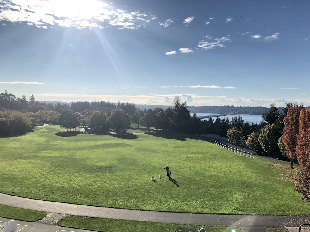
The Park on the Lid, the Mountains to Sound Trail, the Boat Launch and the Greta Hackett Outdoor Sculpture Gallery are all part of Aubrey Davis Park. The City of Mercer Island is leading a master planning process through the fall of 2019 and we need your input! Please help shape the future of this essential community park by participating in the discussion below!


Aubrey Davis Park is WSDOT land and the trail across the park was expressly designed to provide a safe way for bicycles to cross from the floating bridge to the East Channel Bridge. The city and WSDOT understood that some pedestrians would use the trail, however, that was a secondary design purpose. While some experienced cyclists do use North Mercer Way instead of crossing the lid, most cyclist feel safer riding on the trail. WSDOT has repeatedly advised the city that the trails should be made wider to better accommodate both bikes and pedestrians. The state recently provided a $500K grant to make the trails safer, not to push bikes on the roadways to contend with automobile traffic. The gold standard would be to separate bikes and pedestrians across the lid. The current city SEPA envisions this separation by adding a new pedestrian trail and rerouting bikes behind the toilets. We all share the goal of making the park safer, but moving bikes off a WSDOT designated bicycle path onto more dangerous streets is not the solution Separating bikes and pedestrians as envisioned in the new master plan will improve safety for everyone.
My wife and I enjoy walking in the Lid Park during the summer months, when the weather is friendly. I am very concerned about walkers and bicyclists sharing the same pathways on the Lid Park. Why are bicyclists allowed to ride through the park at all? Why aren't they directed to West Mercer Way after crossing the Floating Bridge and arriving on Mercer Island? As my wife and I are walking in the Lid Park, bicyclists pass us going 10-15 miles per hour. They are very quiet. You can't hear them coming! We're lucky if we receive a heads-up warning, "On your left," from them. I often ask them to slow down, but sometimes they can't hear me because they're wearing headsets! While we stay on the right side of the path, what if I wanted to cross over the path to the left and pick up a piece of paper or debris? I could be hit and seriously injured, and possibly killed, if a bicyclist struck me going 10-15 miles per hour. Therefore, I believe bicyclists should be banned from the Lid Park. Let them ride on the public streets to go around the Lid Park, where they can ride as fast as they wish. If that isn't possible, how about limiting them to the route on the north side of the park? If this were adopted, you won't need to spend additional dollars converting that route to an "informal soft surface," as proposed. We oppose changing any of the path surfaces to a "soft surface." We would object to your implementing this strategy. Finally, if bicyclists are allowed to continue riding through the Lid Park, speed signs should be erected at regular intervals, limiting speeds to 5 miles per hour. Walkers have the right of way and should be the first priority in the Lid Park! There could be a serious accident of a bicyclist running into a walker, given the lax rules and standards posted currently for bicyclists.
We read the commentary on "vegetation management." We think the plant selections for the Lid Park have been good, but we see little vegetation management! As examples, we've noticed two to three dead trees in the park that have been left standing for months. We've wondered about potential liability for the City of Mercer Island if a tree fell on someone. Apart from the lawns being mowed and leaves raked, we don't notice much in the way of vegetation management in the Lid Park.
We certainly support getting rid of as much ivy as possible!
In terms of reducing water consumption, we would favor Option 2: Install lower maintenance meadows rather than Option 1: Brown outs and Option 3: Keep watering.
This concludes the comments we'd like to make regarding the Lid Park. Thanks for giving us the opportunity to share our thoughts.
Erick and Judy Leithe
The final open house this week included some excellent elements that will increase the public's opportunity to enjoy both Luther Burbank Park, the Lid and Upper Luther Burbank's 22 acres of woods. Item F which will be a trail from the south parking lot to the lid. Item G. which is a connecting set of stairs up from the lid to 84th Avenue and Upper Luther Burbank Park. Item I to increase lighting along the retaining wall and Item K which will complete the Upper Luther Burbank Park Ravine trail which will essentially allow citizens to have a path to finally complete the northern pathway from Upper Luther to the existing path already at the Shorewood Apartments therefore completing a trail through Upper Luther Burbank Park's ravine and eastward where there is no outlet at this time. This is a final trail to traverse the island.
It would also be helpful to have better wayfaring signs - or possibly paint and plantings that would link the Sculpture Park to the Luther Burbank Lid. Right now the Island Crest Way intersection at I-90 does not clearly inform pedestrians of access to both Upper and Lower Luther Burbank Park over the double wide lid. Years ago our Mercer Island council led by then Mayor, Ben Warner fought hard to insure that Luther Burbank Park would "resemble" a park even after I-90 cut it into two pieces.
This Master Plan should ultimately allow for transportation safety into the future while emphasizing the value we all share regarding our green spaces, parks and the Mountains to Sound Greenway's vision. I hope it becomes a national example of a green, yet working freeway for all future types of transportation - respecting pedestrians as well. Aubrey Davis wished the freeway - not be seen, heard or smelled. This effort is moving his dream forward.
There have been several changes to the ADMP in just the last few weeks, without any public process. I have posted about some of these on ND. https://nextdoor.com/news_feed/?post=124856548
Probably the most significant change or proposal is a second bike trail that separates from the current trail as it descends from the tennis courts and then winds behind the bathroom. In past ADMP plans there were two alternatives: 1. A round about and gathering area in front of the bathroom that would serve to calm bicycle speeds; and 2. a separate bike trail that would separate from the main path right before the bathroom and then wind around the bathroom, also designed to calm bike speeds. Both proposals would require some kind of traffic calming at the bottom of the hill near the backstop.
This new plan would start the bike path up the hill, much closer to the curve near the backstop, and run it along the parking lot and behind the bathroom. There are some serious issues with this new plan that I don't think were well thought out, probably because this idea was created in the last two weeks without any public process:
1. There is a large concrete support pole for the overpass in the middle of the new proposed bike path.
2. The cost for this new trail is prohibitive when the city is facing budget shortfalls and has many other pressing park capital needs.
3. This new trail would create 22' of combined paved surfaces when combining the width of the existing trail (12') with the new trail (10') although some bike groups want the new trail to be 12' wide which would create 24' of paved surfaces before shoulders.
4. This new trail would encourage bike speeds coming down the hill when the goal all along has been to slow bike speeds through the lid park, and calming bike speeds before the backstop was a major concern during the Parks Dept. presentation at the parks commission meeting.
5. The new bike trail would run along the edge of the parking lot after a blind corner where kids are entering the ball fields, and this parking lot is ADA accessible, creating a lot of danger from speeding bikes.
6. The new trail would remove all vegetation between the fields and parking lot and retaining walls that screens the fields and park, and already the parks dept. has removed a significant amount of screening vegetation.
The other new addition is a separate soft path that sort of follows the current bike/pedestrian path. The problem here is I don't think pedestrians will use it, especially when wet, and because near the basketball courts it is as steep at the current paved trail from the basketball courts to the tennis courts.
A better solution to minimize bike/pedestrian conflicts is to encourage pedestrians to use the trail that winds along the stacks behind the tennis courts (which means no fenced off-leash dog area, an idea I believe won't even make it to the council it is such an unpopular and incomprehensible idea, if no other reason the entire park is off-leash).
During this 18 month process probably the number one concern was slowing bikes through the lid park since the mixed use trail is primarily used by pedestrians. That has to remain the basic concept. The two key areas for traffic calming are at the bottom of the hill right before the backstop, and at the bathrooms. I am not sure bringing this new, unvetted idea that is unaffordable and dangerous to the council is a good idea for the parks dept.
The other issue is credibility. Throughout this process the feeling among the citizens who participated from the first focus group meeting is the parks dept. was not transparent with the citizens, or open to the citizens' ideas. This attitude changed after the defeat of Prop. 1.
Effectively there has been no public process on the current plan because even at the second public meeting -- after all four focus group meetings -- the city presented two plans, both of which the citizens hated. This new bike path wasn't even part of the parks dept. presentation to the parks commission three weeks ago, which I attended, which I think raises issues with the SEPA application notice.
I can live with the 12' wide path east of the TC although use numbers don't support 12' of width (and WSDOT originally recommended 10' and KC balked at 14' due to cost) if the 2' gravel shoulders are overseeded or allowed to grass over.
As I have posted before on ND this bike path will never be a good bike path because so many parts of it are 8' or less in total width, and so a 12' wide paved path with 2' gravel shoulders is impossible anyway in many areas. I just want to make sure trees are planted on each side of the trail -- against the I-90 retaining wall and either NMW or private houses to the east -- no matter the available width. That is going to be tough because there is suppose to be 2' of shoulder between the actual paved bike trail and tree trunks, which means at some points the bike trail could be 4-6' in total width.
The Lid is just fine as it exists now. I was just there today and I have no complaints that merit all the money that you might spend on this project. The survey is a joke because it takes so long to read, comprehend and respond that even a retired person would be hard pressed to have enough time to complete it.
I suspected that the City might use this project as an opportunity to restrict the access of unleashed dogs to the Lid park and I know now that I was correct. I see that there are plans for an "unleashed dog area." Based on the Luther Burbank dog park this is code for a mud hole that is used more heavily than the rest of the park put together but only occupies a small fraction of the park land. The design of the Luther Burbank dog park is probably the design of somebody who doesn't even own a dog. Their thinking is that dogs like to play in the mud so lets give them some mud in which to play. Actually dogs like grass more than mud and so do the dog owners.
So my advice to the Park Department is, don't waste money on a dog park and don't even think about changing to policy for dogs off leash on the Lid. Any City Council member who votes for a dog park and restricting unleashed dogs on the Lid will loose my vote in perpetuity.
Improving the safety of our trails and the park by bringing our standards up to date is a unique opportunity that should not be missed. Let’s look at two elements in the discussion: ownership and safety
Ownership. Many people on Mercer Island seem to assume that Aubrey Davis Park is entirely a city park owned by Mercer Island. It is not.
A vast majority of the park is owned by WSDOT, and WSDOT pays the city for its maintenance. This ownership situation was established decades ago. As for the I-90 bicycle trail, WSDOT documentation shows that the I-90 trail was built solely with transportation funds, and the trail was designed and built primarily for bicycles, although some pedestrian use was envisioned. King County calls the I-90 Trail one of its most important regional transportation trails.
Safety. Much more importantly, widening trails and separating bikes from pedestrians will make the park safer for everyone—pedestrians, kids, families and cyclists.
E-Bikes, E-scooters, and cycling in Seattle, the east side, and Mercer Island are growing, which means that multimodal traffic on park trails will increase. East side communities and King County are already investing heavily in improving bicycle infrastructure, including $200M along the East Trail corridor running from Renton to Redmond. Seattle too is improving its bicycle infrastructure. Most of the big tech companies which are rapidly expanding in the Seattle and the east side have programs to encourage employees to commute by bicycle.
The current trail width was based on 30 year old standards which were questioned as being inadequate at the time. Now the current King County standard is a width of 12 to 14 feet, and WSDOT recommends widths of 12' and above for shared use trails "when substantial use by both pedestrians and bicyclists is expected". National group AASHTO is currently revising its minimum upward from 10" widths, and currently recommends widths of 12 to 14 feet on shared trails where heavy use is anticipated.
In recognition of the growing traffic on the trail, King County and the state are funding most of the cost of the master plan. In addition, the state recently made a $500,000 grant to the city to improve the safety of the trails in the park. King County has agreed to restore the portion of the trail its sewer project tears up to 12 foot width at its own cost. A 12 foot width for all the shared use trails in the park only makes sense.
The Aubrey Davis Park Master Plan is a unique opportunity to improve the safety of our trails and the park by bringing its standards up to date. This opportunity should not be missed.
July 1, 2019 Nextdoor Post:
I think Kate raises an excellent point that I raised during the ADMP about impervious surfaces being part of our development code for parks.
There are four key points to protecting the parks, and a fifth financial reality:
1. The first is zoning. Parks are a special zone within the "public institution" zone. Any development must be "park related" like a parking lot or tennis court or trail.
So the first and most important factor is to prevent the rezoning of parks, like the linear parks next to Freshy's and Tully's, which changed them from parks to five story mixed use developments, which effectively eliminates them. I think eliminating parks because the city is having financial challenges is very short term thinking, and am glad prior generations and councils didn't feel this way
Another good lesson for any council is to consider that although a piece of property might not be technically zoned "park" like Kite Hill, which was zoned public institution, if the citizens believe it is a park then it is a park, zoning or no zoning designation. Which is why Kite Hill was later added to the Luther Burbank park designation and master plan by unanimous council vote (after the bruising fight over Kite Hill). The citizens always thought or assumed Kite Hill was part of Luther Burbank park, and trying to explain the distinction between development in a public institution vs. park zone was a losing battle for the council.
2. The "use" allowed for parks vs. open spaces is much different. This was apparent when the open space conservancy board held a meeting to consider adding the parks to the open space trust that pretty much includes just Pioneer Park.
The open space board is a sleepy board that meets once per month. Managing the parks for sports, recreation, maintenance etc. is a huge undertaking. Like Kate notes the parks are expensive (the 2018 budget was over $5 million) and open space generates no revenue whereas parks do.
So even if the parks are protected their use will pretty much stay the same, although there are some concerns too many off Island organizations are using our parks. There has to be a balance between recreation and open spaces in our parks, which is a good issue for the new parks board.
3. As noted above park designated land is limited to park related development. The actual development regulations for things like height and GFAR and lot coverage are the same as the surrounding zones, which I think are all residential neighborhoods. So height limits are 30', lot coverage 40% etc., although only height limits are really applicable because parks usually have much higher percentages of green spaces to developed spaces than a residential lot.
4. What the ADMP process taught us is that even park related development can ruin the use and character of a park. For example, the ADMP has proposals to replace one field with artificial turf, pave a portion of the grass field along WMW for a parking lot and another lot where the trees are along 24th, and either widen the path to 18' or add a third dedicated bike path that would require removing many mature trees and greatly increase impervious surfaces. Technically these are park related developments, but they would change the character of the park to a regional, super active park with a lot less green spaces and solitude.
During the first focus group meeting for the ADMP (which many of us felt was not a fair or open process because the decisions had already been made) we were asked to say one word or saying to summarize what we wanted for the ADMP. My comment was not another inch of impervious surfaces, because I think we have enough concrete in our lives, although for reasons I don't understand our parks department and outside regional parks consultant just love concrete.
That is why I think Kate's idea makes sense. There are a lot of special interests after the park land, and many times their plans include concrete and development of green spaces. If we are going to protect our parks, we need to protect the zoning, but also the park related development so we don't lose what is special about our parks. The best way to do that IMO is to limit any new impervious surfaces in the parks, and ideally begin to lower impervious surfaces. Kids can play baseball on grass just as easily as artificial turf, and artificial turf fields are better placed at the school fields like the middle school.
5. The ADMP will probably be shelved in the next month, in part because I think Jessi Bon understands what I have been telling her from the beginning: for the city protecting the parks is probably necessary to renew the parks levy that expires in 2023 and contributes close to $1 million/year to the general fund. It is also the right thing to do. The ADMP as written is a transfer of a local park to a regional park in a residential neighborhood.
If there is one basic unwritten rule about the parks I think it is citizens really do not like change to their parks. After all, the parks are a real jewel on the Island. Ira Appleman posted that in 22 years of attending council meetings he could not remember a single citizen asking for change in the lid park, so why was the city and council proposing such a massive change, especially during a levy ballot.
For a council or city -- especially one with financial challenges -- there are few things less wise than to propose change to the parks, especially if no one is asking for change. As I told Jessi, if the ADMP went ahead as proposed by the outside consultant (and to be fair to Jessi she inherited the ADMP and was out on maternity leave when many of the questionable decisions were made) the citizens would cut off the parks levy money, and then not only would there not be an ADMP there would be no parks dept.
If the city and parks dept. had begun the process with Kate's idea about restricting new impervious surfaces in the parks none of the proposals the citizens objected to so vehemently would have been possible, and a lot of political damage would have been avoided.
When you are facing "financial challenges" like the city decisions are a lot simpler. Take the money.
Please create Pickle Ball courts.
Please be sure that resurfacing of the 4 tennis courts in Aubrey Davis Park are included in the funded improvements. The cracks in the courts are HUGE and unsafe. The courts are not useable for serious tennis matches now. Thank you!
Thanks for attending the Farmers Market on 6/2 where I learned about the great ideas being considered for Aubrey Davis Park. I LOVED the idea of building a rock climbing course. This could be expanded into an outdoor adult playground, which doesn't exist on Mercer Island apart from the small circuit at Mercerdale Park. A purpose built space could do so much to encourage outdoor exercise and mobility throughout life! Ideas: 1) purpose built parkour playground https://parkourvisions.org/design 2) Covered outdoor space (open air) for tai chi and general movement practice 3) flattened lawn areas for outdoor fitness classes 4) water bottle filling and restrooms. There are many residents on the island in the fitness and movement world, as well as other local connections, who can help design and provide input. Happy to help coordinate. I echo others that maintaining the walking trail is of utmost importance - one of the reasons Greenlake is so successful is the 2.8 mile flat paved path.
I just completed your survey. It was very difficult to understand and reply.
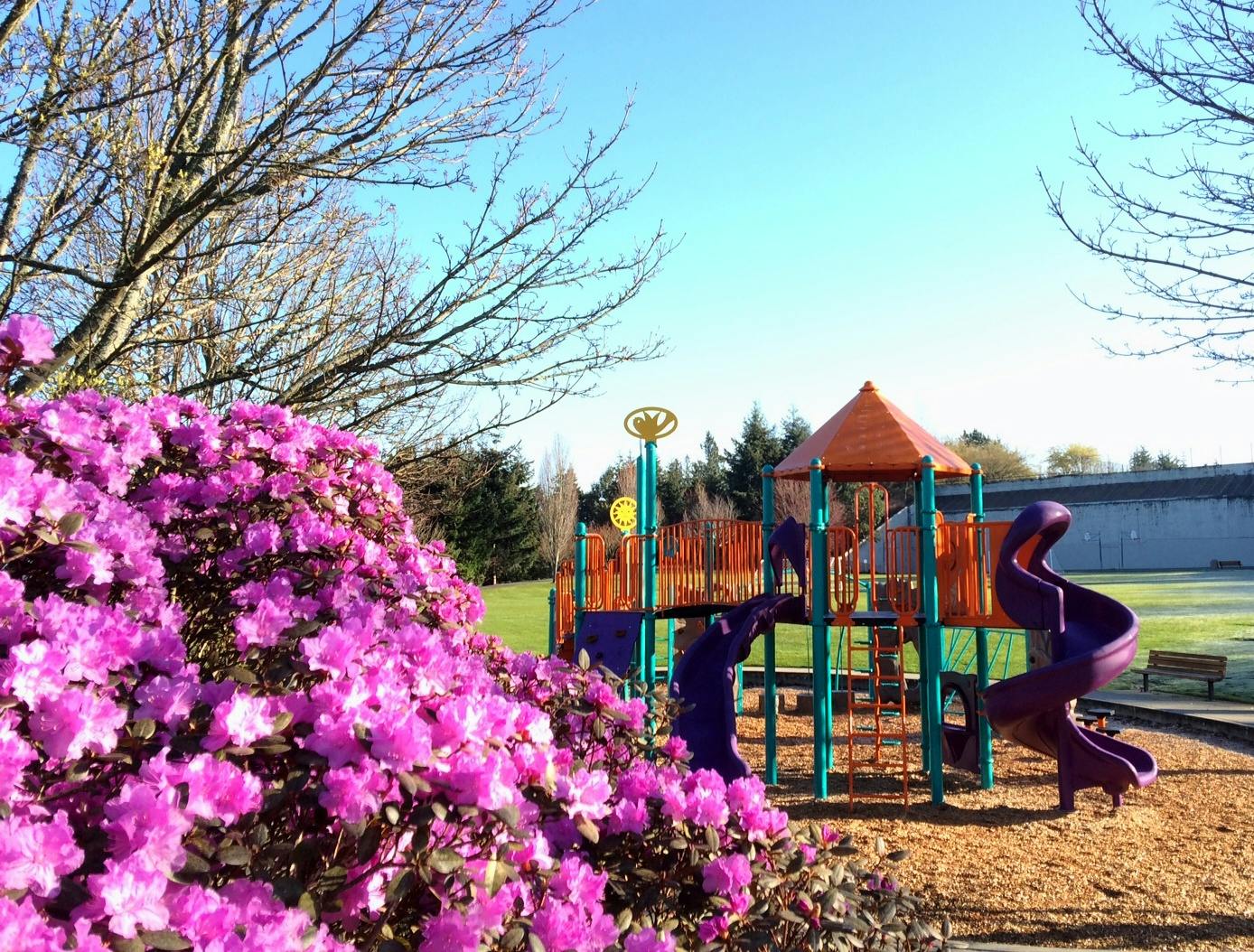
It's clear that there has been a lot of thought put into this (thank you!). In general, the redesign options are gorgeous. I took the survey yesterday but afterwards I had more time to think about it and when I step back, I really appreciate the trail enhancements but think the proposed play structures and features are almost too gorgeous if that makes sense (they look like art; I'd be freaking out about kids playing on them).
What we could really use instead are more year-round or multi-season ball fields, better parking, and restrooms. I've had kids in sports and been a parent assistant and it's almost impossible to get to the fields on the lid, drop-off/pick-up and/or park, and if you have to take a kid to a bathroom or to find water that can be a real trial in itself! Rather than having lots of sculptural play areas for young kids, let's have a very active field environment where we can host tournaments and ensure adequate playing space for all of our girls and boys teams (soccer, lacrosse, etc.). Let's make sure we don't lose the lacrosse wall, because it's the only one since IMS was redesigned. We need more active features/options for older kids/tweens/teens. Please provide some seating with coverage to watch play; not just for grilling or looking at the views. There is also room for some younger kid structured play areas, but multi-season fields will accommodate people for a much longer span of time. Thanks for your consideration.
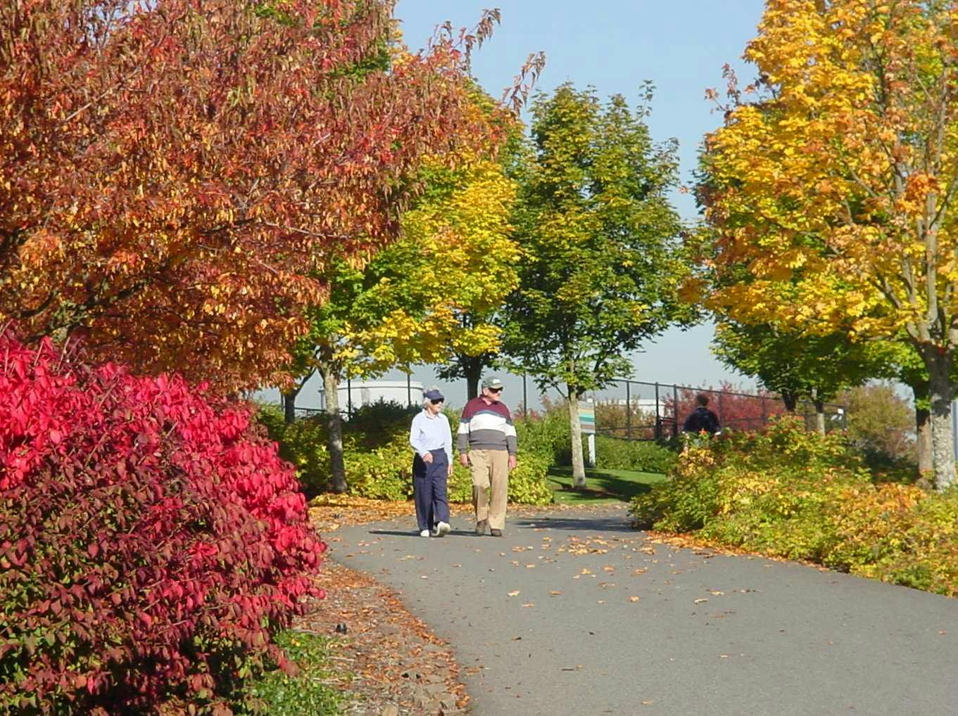
I am a daily user of the Aubrey Davis Park on the Lid and have been since the park’s inception in 1990. My biggest concern in this park redesign is the safety of all trail users within the park. It is critically important to separate higher speed users of the trail such as conventional bicyclists and the growing number of e-bike users from slower walkers, children and dog walkers. It concerns me that a small number of vocal bicycle enthusiasts are attempting to make the case that the bike route should go through the park and off of all roads, when the speeds that these bicycles travel at is much more compatible with vehicle speeds than that of walkers. My husband is an avid cyclist but he has always felt that, for his own safety, he is better off on the roads than being at risk of entangling with ambling park users.
I attended the ADMP Open House on April 23 and was rather dismayed to find that all the options proposed to re-route and separate the bicycle path through the Lid Park involved complicated and expensive removal of vegetation, re-grading and retaining walls, and one of the plans (the “south option”) eventually dumps the cyclists back onto the walking path (and apparently ultimately through the sculpture garden?)
There is a much simpler and cheaper alternative plan to achieve the same end. It would involve making only a short segment of separated trail for cyclists from the I-90 bridge where it crosses West Mercer Way, up to the area across from the tennis courts where 66th St SE joins with SE 22nd St. At that point cyclists would be routed onto a new designated bike path along the south side of SE 22nd St, which would then turn the corner onto the 72nd St overpass. Once across the overpass the cyclists would make a right turn onto the short path connecting 72nd St to the playfields, on the north side of the existing bathrooms, and then down the hill on the existing I-90 trail. From there the route would have to be worked out, but keeping the bicycles on the north side of I-90 makes the most sense, especially with all the congestion to come with the development of the Tully’s property and parking structures on the south side of I-90.
This plan would get the bicyclists out of the bottleneck and limited sightline problem that currently exists on the curving downhill trail from the tennis courts to the softball fields, and would only involve a short segment on road shared with cars. The 72nd St overpass is not a busy thoroughfare for cars and could easily accommodate a bicycle route. Please give serious consideration to this proposal.
I have walked dogs and grandchildren on the LID Park since it opened on a nearly daily basis. In fact I may have a record for miles walked and bicycled on it's paths.
Shortly after the park opened after dinner one evening, my husband and I and our son's dog entered the park from 72nd street. We were admiring the new plantings near the restrooms and the dog wandered into the path near us. (He was leashed) Before we could react, the dog was hit broadside by a bicycle. The woman riding the bike went over her handlebars and landed on the path. Fortunately the dog, who was a bull mastiff, was unhurt as was the woman, except for severe road burn. She was however very angry and called the police threatening to sue us. The police arrived and tried to calm her and picked up her bike, which was a very expensive model. It had a fancy speed meter which they noted had stopped at 42 mph. They explained that she might want to consider that she was going too fast for existing conditions.
In the nearly 30 years that I have enjoyed the LID park and it's trails, I can say that the single most dangerous spot is in front of the restroom near 72nd. I have witnessed hundreds of near misses of cyclists going too fast nearly hitting pedestrians and dogs. Cyclists come down a steep hill with a blind turn and run into folks who are stopped around the restroom. This path is always filled with dogs getting a drink of water or walkers or cyclists getting a drink or using the restroom. In addition, folks enter the park from 72nd and merge. There are 2 baseball fields nearby which are often filled with users who are young and run to use the restroom facilities and have to cross the path. It is a very congested area and folks and dogs are often not watching for fast moving bicycles.
I think there is a very simple and low cost solution to this problem. Simply reroute the bikes over 72nd and have them reenter the Park behind the restroom and continue down the hill. 72nd is not particularly busy at this point, and the bikes would be slowed because they would not be coming down a steep, blind hill. It would separate fast moving bikes from the congested path near the restroom.
Please consider this easy solution to a big problem.
The bike trails through Aubrey Davis Park are part of the Regional Trail system and are one of two main E-W connections for bike commuters and recreational cyclists. These trails are a key piece of the county's multimodal transportation system. If it is to be safe for everyone and handle the increasing demands on it, the facilities need to be expanded. Ideally bikes and pedestrians would be separated, but failing that the trails need to be widened to accomodate all users safely.
Bikes and pedestrian speeds are inherently different. Few would argue that cars must go three miles an hour on our neighborhood streets because that's how fast pedestrians walk. The heart of the issue is that our infrastructure was built for a transportation system that is rapidly changing, and we need to bring the infrastructure into conformance with the new demands being placed on it.
Where does the data indicate bicyclists outnumber pedestrians 5 to 1on the trail? What part of the trail are you talking about? Your own comment states you avoid the trail because there are too many conflicts with pedestrians and dogs. The data actually show very little bicycle use, especially commuter bicyclists, probably due to conflicts with all the pedestrians.
The issue at the Focus Group meetings was that if the trail is going to be safe for everyone including kids, pedestrians and dogs, then bicycle speeds have to be limited to much closer to pedestrian speeds, because pedestrians can go only so fast -- around 3 mph -- and generally don't pay attention to traffic approaching at high speeds from the rear, especially dogs and kids.
There isn't space for separate trails, one for bikes and one for pedestrians, and history shows pedestrians don't follow markings on trials, and have no legal obligation to move out of the way on a mixed use trail for bikes coming at high speeds from the rear.
Although I disagree with the outside consultant's recommendation for an 18' wide trail that would include 2' wide gravel shoulders on each side, the consultant does recognize a mixed use trail, of any size, will have to have speed limiting measures to make sure bike speeds are closer to pedestrian speeds. Conflicts are the responsibility of the bicyclist, not the pedestrian. For the park itself traffic circles/round abouts are the best solution, and for the trail east of the TC maybe speed bumps or gates.
The only way to have a "safe default for everyone" is to make sure the speeds of bicyclists and pedestrians are similar, especially on declines like through the lid park.
The survey data indicates that cyclists currently exceed pedestrians by a factor of over 5, yet the trail is clearly not designed to mix cyclists and other users. In fact, I currently avoid the trail because I don't feel safe cycling on it. Too many conflicts with walkers and dogs.
As a regional trail, it should meet trail design standards and be consistent with the rest of the trail stretching from Judkins to Sammamish. I am comfortable using North Mercer Way, but I feel that the trail should be a safe default for everyone.
I just took the worst and most biased survey in my life. It is incredibly long, vague and confusing.
The pictures are tiny and cannot be read or blown up. The questions are totally biased. For example every choice on the trail portion includes a 14' wide path with 4' worth of shoulders when WSDOT clearly stated (I reprinted WSDOT's email below in a comment) that WSDOT which owns the property requires 10' wide paths IF there is heavy trail usage, which the actual trail data shows is very light usage, mostly pedestrians. Even the trail through the lid park shows a 14' wide trail and 4' in shoulders. Whenever the survey used the term "opportunity area" I cringed, because what I am thinking about is grass and trees and what the outside consultant is thinking about is concrete and special interests. Can't a park remain a park, without "opportunity areas".
This is exactly what I predicted and what happened during the focus group meetings. The design of the trail east of the TC was already prepared on a blow up before the first focus group meeting. The city's parks dept. and their outside regional consultant had already decided the plan for the park during the scoping process, just like with the light rail station, with the same great results.
The facilitator collects comments and then claimed to the city council that all the comments supported her regional view of developing the park, when every person I heard at the 4 focus group meetings I attended stated they came to make sure the park STAYS THE SAME.
This is the mystery of this project and our council. No council member (and I have confirmed this with more than one council member) has ever sent an email to the council with a complaint about ADP or a desire to change it. I mean no one. The city has reserved zero dollars for the proposed projects and development in its capital fund and just learned the sales proceeds from the sale of the linear park next to Freshy's can't be applied to the ADMP and all go to WSDOT. The two things that are absolutely critical for the park -- a new irrigation system and soil remediation -- to keep the mature trees from dying are not even mentioned in the survey. It is just such an irresponsible exercise in my mind.
The council just voted to rezone two precious linear parks in our TC to five story mixed use development: the parcel next to Freshy's and the parcel next to Tully's. Hasn't the council done enough harm and destroyed enough parkland at least for a while, until we can get a new council that values parks. If I am not mistaken doesn't the council have $28 million in cuts to the general fund to make. Leave our parks alone.
I agree with Bart Dawson's comments below, and think he raises an issue that has not been discussed in the four focus group meetings I have attended to date. I am very concerned at the amount of concrete that apparently is being planned for the 77th St. light rail station. During the focus group meeting I asked Asst. City Manager Kirstin Taylor about the future design for the 77th St. station and was disappointed at her lack of involvement or interest in the design. Basically it was whatever ST wants to do.
80th presents the same issue, especially with changes planned to the linear park along the Tully's project on Sunset Highway this vegetation will be even more critical. We have a very bleak TC with very little open or green space between Mercerdale Park and I-90. Bart Dawson's comment re: solid walls to screen out I-90 and the platform below and more vegetation along the station entrances is a very good idea, but the opposite of ST's approach which favors acres of concrete for minimal maintenance. 80th will serve as the gateway to our TC from the park and ride and NMW and already is very loud from freeway noise. The vegetation is critical to keep the walk pleasant.
I am not a fan of the station design that a council subcommittee of Debbie Bertlin, Tana Senn and Jane Meyer Braum oversaw with very little citizen input. When the "60%" design was released to the public it was really a 95% design, and the rest of the council despite misgivings on the design did very little to amend the design. These are light station entrances on 77th and 80th to a below grade, open air platform sandwiched between I-90 that should have been minimized in scale and height with vegetation, but instead are "celebrated" with tall roofs and bizarre orange funnels.
From what I have heard ST is interested again in moving the bus intercept from NMW and 77th to 80th although the city refuses to release any details or keep the citizens in the loop, while at the same time refusing to negotiate with ST over anything. That would be a huge mistake. 80th and 77th will be critical for north/south traffic -- cars, bicycles and pedestrians -- from NMW to the town center, and 80th needs to retain its width and size, and vegetation, to provide a safe and pleasant gateway from NMW to our TC and future Tully's project.
Statement concerning the 80th Avenue SE Bridge over I-90
I expect that Sound Transit, WSDOT, and the City of Mercer Island will work together to preserve as much of the existing wide bridge for practical, aesthetic, and legal reasons. In fact I believe that the three governmental agencies, by existing governmental agreements, have already committed themselves to preserving the wide 80th Avenue SE bridge.
The rationale for retaining shrubs and trees on the 80th Avenue SE Bridge starts with the “1971 Mercer Island I-90 Design Report.” The report states on page 48:
"The greatest concern of Mercer Island residents is that the new corridor not be a divisive force that will further separate the existing residential areas north of U.S. 10. In order to re-establish the relationship to the north end of the Island, wide bridges are recommended at the streets which cross the corridor. These bridges will include landscaping and pedestrian walkways so that persons crossing the corridor, whether in an automobile or as a pedestrian, will barely be aware of the traffic passing beneath. The continuity of the ground plane over the highway will form a strong physical and visual connection."
The 1976 Memorandum Agreement committed the signatories to implementing the 1971 Design Report by stating that:
"4. The parties further agree … that the modified design of the [I-90] facility will preserve and incorporate all of the provisions for community amenities and for reducing adverse environmental impacts as contained in limited access plans adopted by the State Highway Commission for (a) the segment from the West Shore of Mercer Island to the East Channel Bridge …."
The signatories of the 1976 Agreement have respected the 1976 Agreement. The I-90 facility we see today implements all of wide bridges and landscaping contained in the 1971 Design Report.
In the 2004 Amendment to the 1976 Agreement Sound Transit committed itself to fulfilling Metro’s responsibilities concerning high capacity transit on I-90, thereby also committing itself to the 1976 Agreement.
Within the constraint of providing pedestrian access to the light rail station, the City, Sound Transit, and WSDOT should honor their 1976 agreement, and the intent of the I-90 Design Report, and preserve the 80th Avenue SE bridge to “include landscaping and pedestrian walkways so that persons crossing the corridor, whether in an automobile or as a pedestrian, will barely be aware of the traffic passing beneath.”
Just retaining or placing shrubs and trees on the bridge is not sufficient. Ongoing maintenance will be needed to ensure the landscaping survives. Since plants and trees on the concrete bridge are in shallow soils, different from their natural environments, they need water and periodic replacement when they get too large. Today, many trees have been cut down and not replaced. Does the City or WSDOT follow a maintenance agreement that honors the 1976 agreement, and that preserves the landscaping?
For the record, I believe that the existing plans for modifying the 77th Avenue SE Bridge allow excessive visual transparency down to I-90 and to the light rail tracks and trains. The planned Bridge modifications will not comply with the intent of the 1971 I-90 Design Report. However, if the walls at the edge of the bridge were solid, and not transparent, the bridge would meet the intent of the 1971 I-90 design. Not a big change, but in keeping with the 1976 agreement
Bart Dawson